The Ochre Dyke Corridor |
|
Please read what Wikipedia says about the Ochre Dyke. https://en.wikipedia.org/wiki/Ochre_Dyke Local Knowledge and Understanding of the Ochre Dyke:
|
|
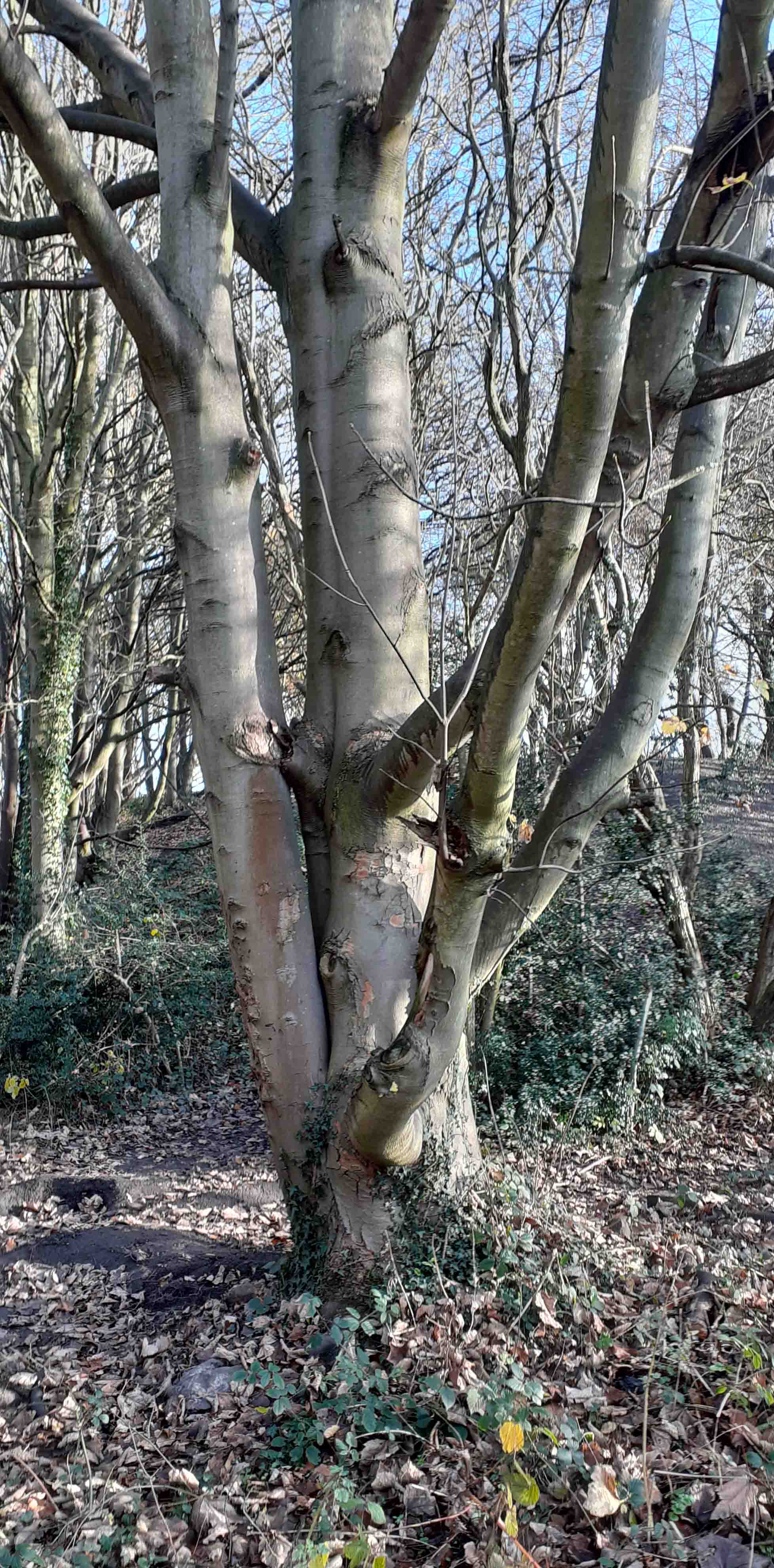
The header waters of the Ochre Dyke are situated in Birley Woods about 650ft above sea level. Wildlife such as frogs, newts, water voles and other wildlife live there. Ochre Dyke flows east/south east along the southern border of the golf course and passes through Birley Wood; up to this point it is the county boundary between South Yorkshire and North East Derbyshire |
 |
 |
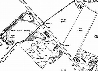
The Ochre Dyke then passes by Birley Moor Pit / Dent Main Colliery. The Ochre dyke gets its name from the pollution of the water by yellow ochre (Iron Oxide) as a result of coal mining activity in the upper reaches of the valley. The area in and around Birley wood was extensively mined for coal and black-band iron ore from at least the medieval period up to the mid 20th century when Dent Main Colliery closed. Other mines along the course of the stream were Moorhole Colliery East, Moorhole Colliery North and Moorhole Colliery South. |
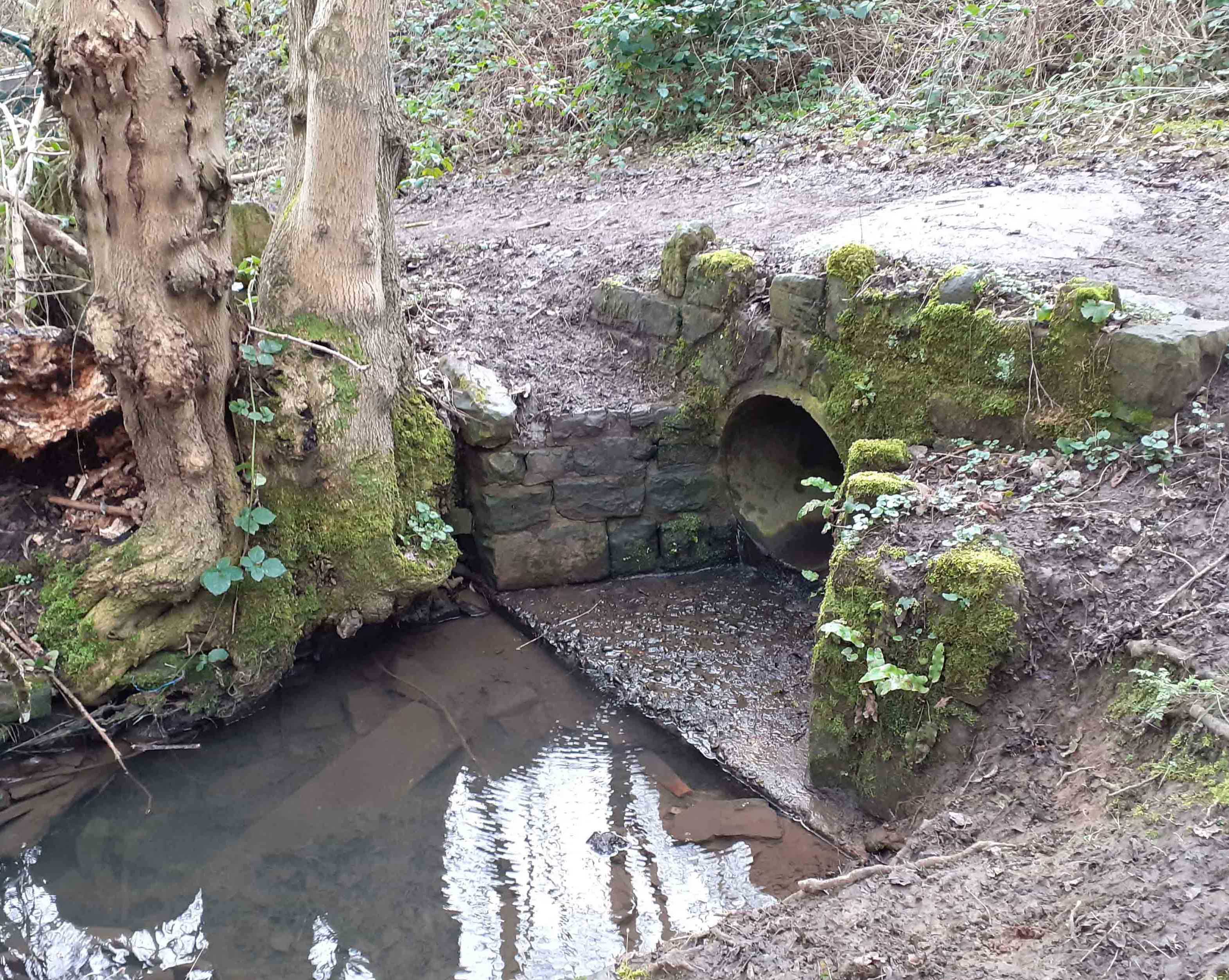
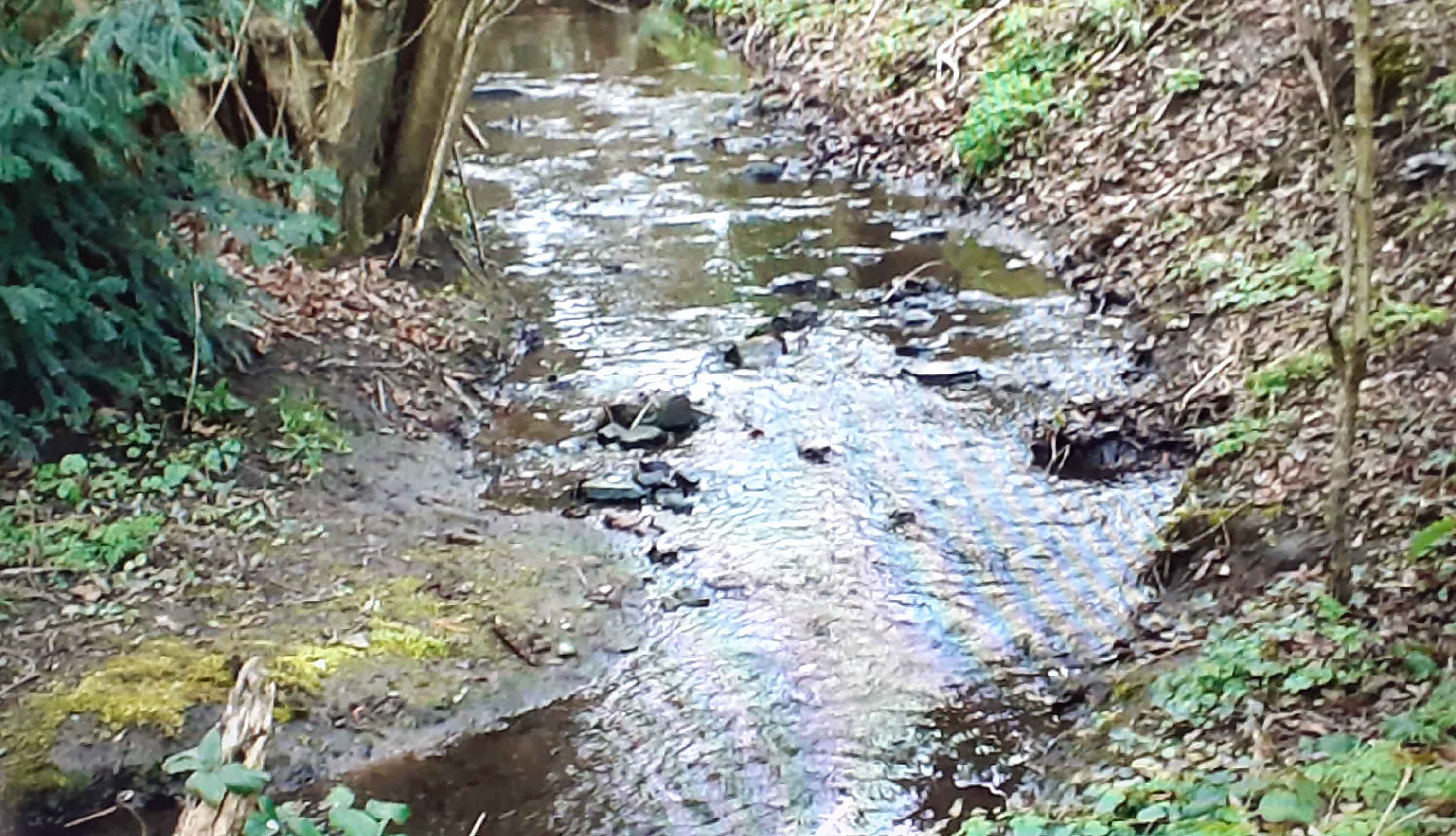
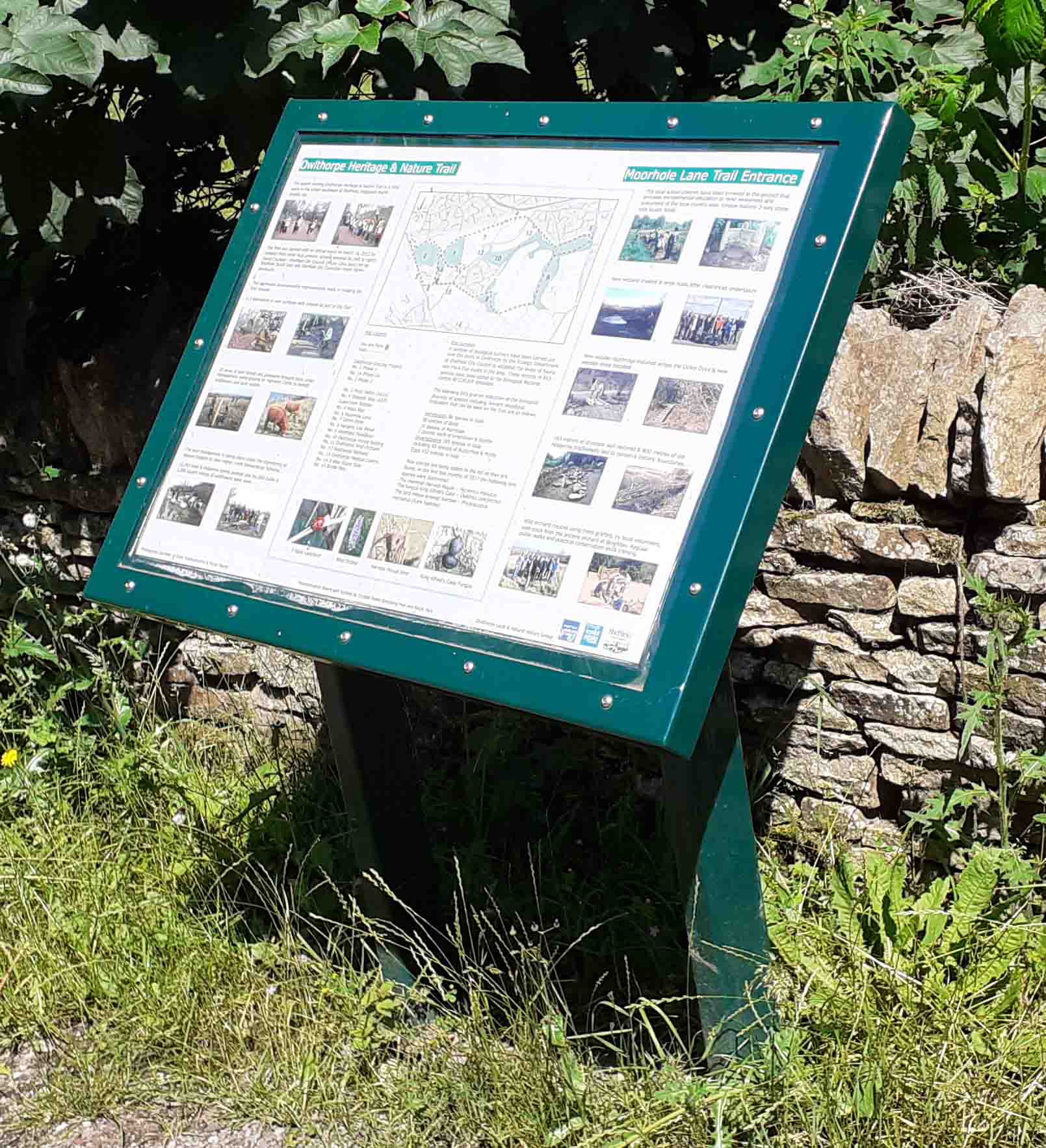
The Ochre Dyke then passes by Birley Moor Garden Center and through the colvert on Moor Valley, it then runs passed Moorhole Colliery which is situated in Owlthorpe Heritage & Nature Trail. |
Link to Video: Colvert |
Link to Video: Upstream Ochre Dyke |
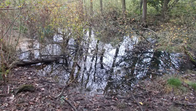
The Ochre Dyke then carries excess runoff water from Owlthorpe Grass Land Grazing Project, which holds millions of galons on water upstream slowing the flow of water into the Ochre Dyke. The video oposit shows the gental flow of water into the Ochre Dyke at the bottom of Royston Avinue |
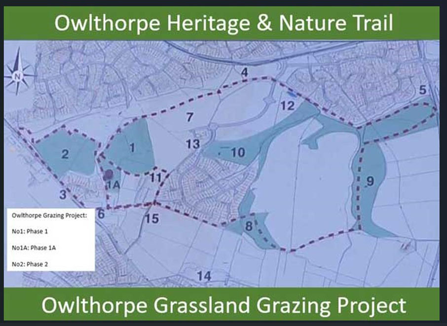
The award winning Owlthorpe Heritage & Nature Trail is a rural Oasis in the urban southeast of Sheffield , England 's fourth largest City. Opened with an official event on March 16th 2012 by children from three local primary schools assisted by Clive Betts MP for Sheffield South East, David Caufield and Sheffield City Councillor Helen Mirfin-Boukouri |
|
 |
|
Roger Marsh explains how he helped found Owlthorpe Community Forum, and was Chair from 2008 to 2012. In 2012 I formed and chair Owlthorpe Local & Natural History Group. Over these 15 years they have carried out numerus environmental projects in Owlthorpe in conjunction with Sheffield City Council (SCC). These projects have created a green oasis, in an increasing urban development, for the local residents and visitors to enjoy the green lungs of Owlthorpe. These projects are important to their mental, physical health and wellbeing. Organised health walks continue to take place every Thursday for both striders and strollers. |
|
Link to Video: Water Retension Plot E |
The Ochre Dyke then passes down through Owlthorpe Fields. Owlthorpe Fields Action Group have had a long battle to save plots C,D and E. Although plot E is lost it is hoped that Owlthorpe Fields will be able to secure Wildlife Sanctuary Status for plot C and D please support Owlthorpe Fields Action Group in this endeavour.
|
|
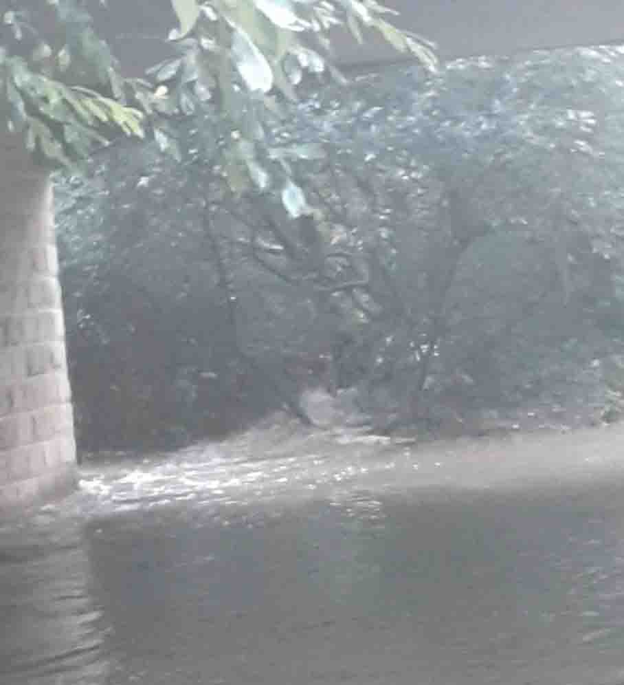
October 2023 Sheffield Flooding again. |
|
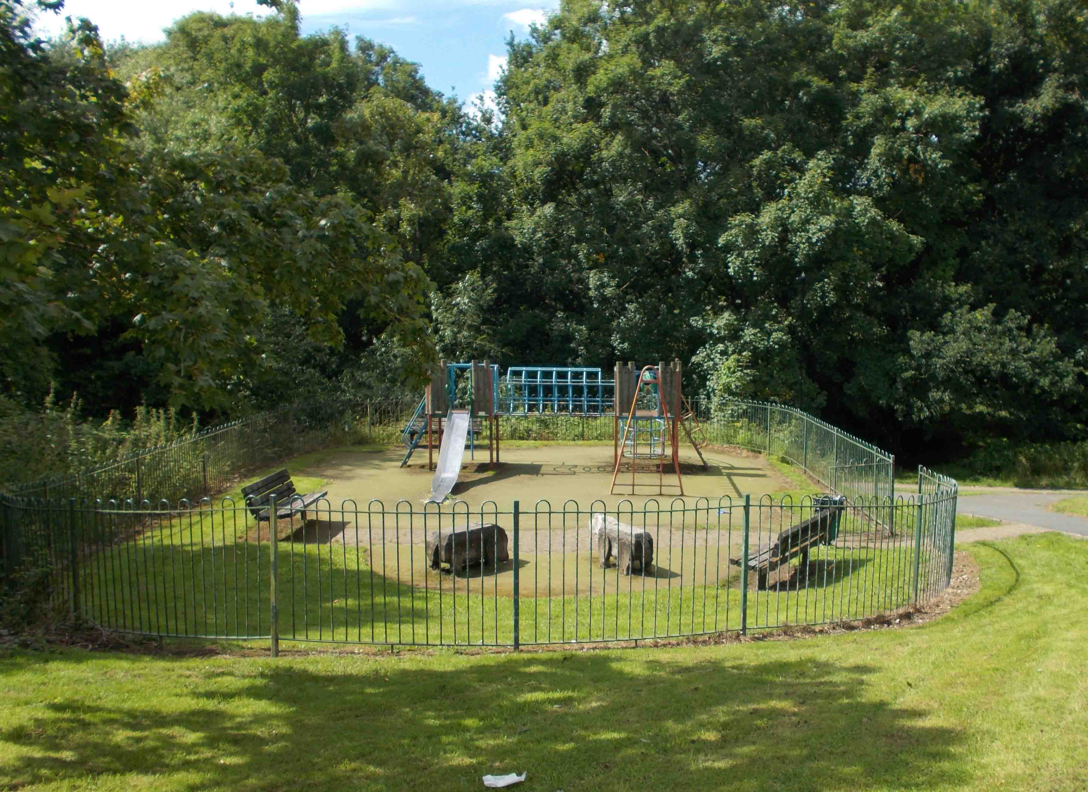 |
Both spurs of the Ochre Dyke then meet opposite the playground at Edenthorpe Grove at the bottom of Owlthorpe Forest Settings then through Westfield Plantation. The water is then carried past Crystal Peaks Shopping Centre standing at approximately 183ft above sea level, then into the River Rother and on to the River Don.
|
Link to Video: Ochre Dyke flooding |
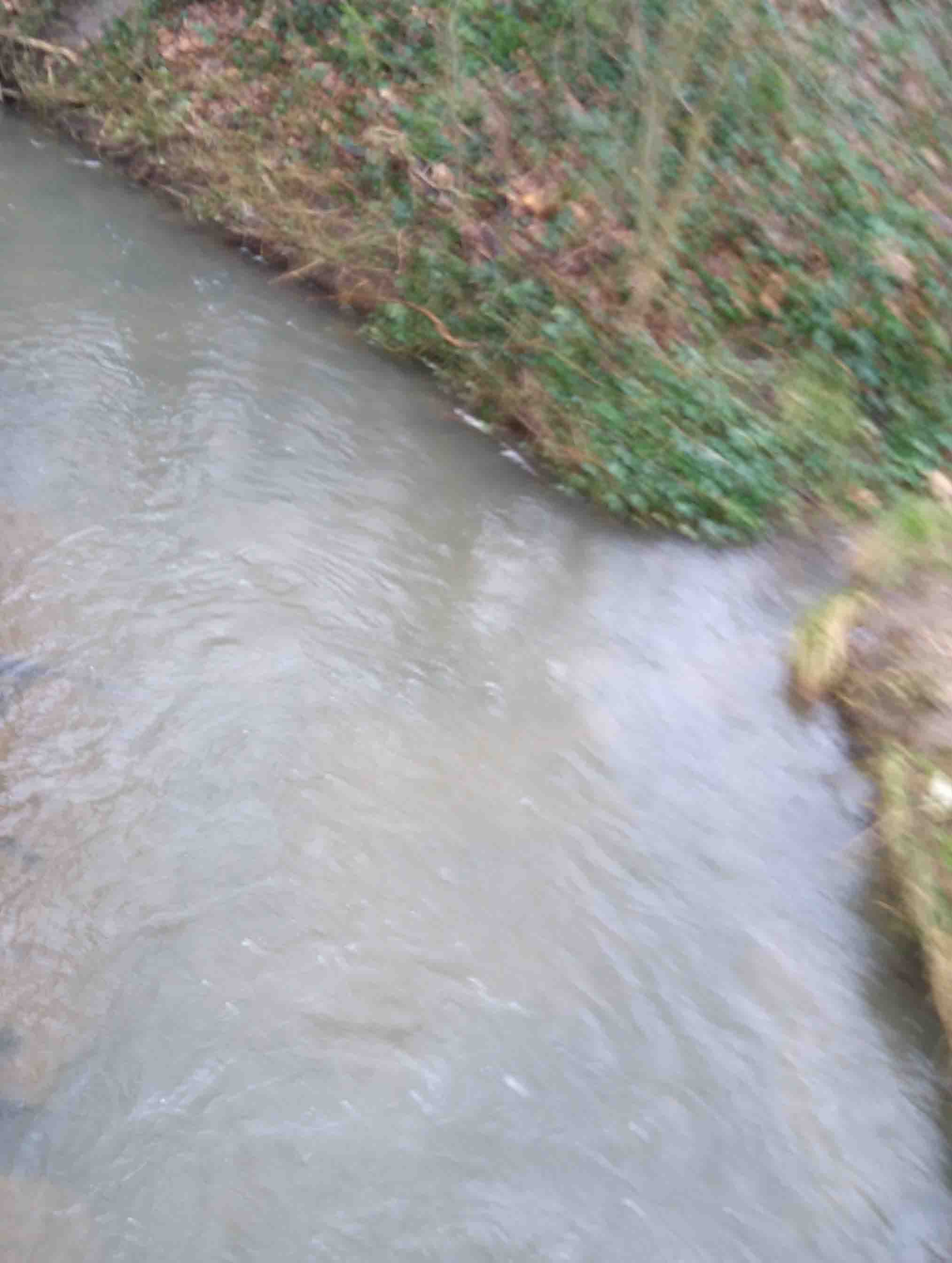
When I took this video behind Crystal Peaks , I also explored where the ochre was coming from, I looked up stream from the culvert opposite Birley Moor Garden Centre down to the playground behind Edenthorpe where the two spars of the Ochre Dyke meet. The water was crystal clear so this was not runoff water. The ochre water was coming from the old Mine workings. |
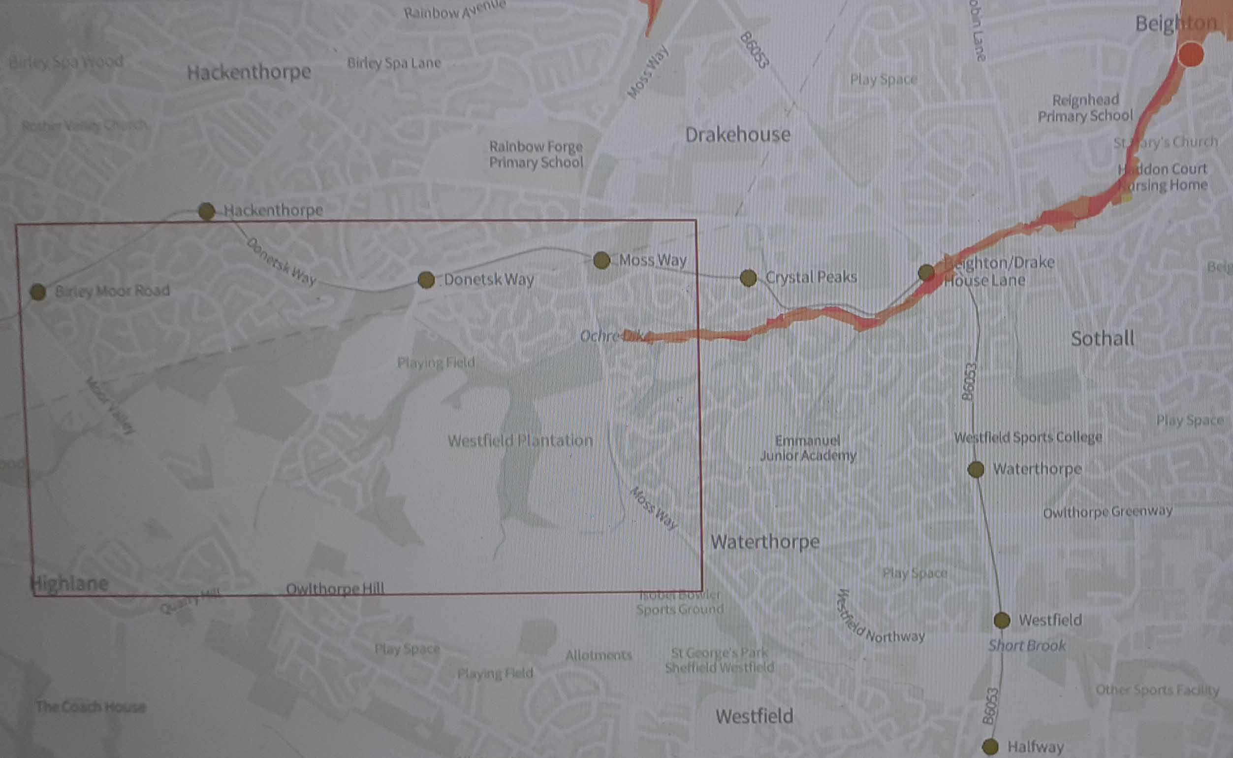
The Map below shows that the flood risk in Owlthorpe is from Moss Way all the way down to the river Rother. The video above, taken behind Crystal Peaks, shows the Ochre water flooding out of the old mine workings. |
|
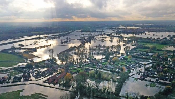
Downstream flooding in Beighton Sheffield. |
|
If we do not protect the upstream Owlthorpe Grasslands the results will be even more devistation for residents living downstream in Baighton.
We also need to protect the Beighton flood plains to stop flooding downstream when the water table is full the disused mine workings flood and the Ochre Dyke turns the Ochre colour it is famous for. Please follow the Video Link: Ochre Dyke flooding which shows that the colour of the tributary in clear, but when the Ochre Dyke turns the Ochre colour, this is a tell tail sign of flooding downstream. As you see in this video https://www.youtube.com/watch?v=v9HCktzI3gE the flood plains of Beighton are the next in line to flood when water from Ochre Dyke accumulates.
The Beighton flood plains hold millioins of gallons of water but when full the water then flows into the River Rother. More Flooding occurs down stream with the confluence of the rivers Rother and Don in Rotherham. My wifes cousin was flooded out at this point and has had to find new accomodation.. It is not nice to lose all your posesions believe me. The flood waters then carry on downstream through Doncaster and on to Fishlake.
We all remember the flooding in Fishlake and the devastaion caused to many families. Some of the water that ended up in Fishlake came from the Ochre Dyke its head waters standing 650ft above sea level. Fishlake stand only 18ft above sea leavel, a difference of 632ft. Fishlake is some 37miles down stream from Owlthorpe make no wonder it flooded. Government Directive https://www.youtube.com/watch?v=bbYXEDczL-UIn this Sophie Ridge interview George Eustace explains the government's response to UK floods: An extra £4 Billion to be spent on flood defences. In Yorkshire up stream nature based solutions are to be supported. Owlthorpe Heritage & Nature Trail has recived government funding from Natural England Under their Higher level Stewardshipe Scheam, please view map. It is only when Sheffield City Council stopped receiving funds did Owlthorpe Heritage & Nature Trail become vulnerable to Sheffield Planning Department, who now want to destroy our Oasis and propose to build 150 new houses on site. Published 2nd February 2023 Natural England unveils new Green Infrastructure Fraimework. "Guidance will create nature-rich towns and cities, helping millions realise the benifits of accessing nature. As a comprehensive tool, the Green Infrastructure Frameworks and accompanying Design Guide will support local planning authorities and developers design and create more nature-rich urban greespaces to meet mandatory Biodiversity Net Gain requirements and support development of Nature Recovery Network. "Natural England's commitment is that the public should be able to access green space or water,such as woodlands, wetlands, parks and rivers, within a 15-minute walk from their home." Government Press Release: "Environment Bodies set joint vision to tackle climate change. Environment Agency, Forrestry Commission, and Natural England outline a shared vision to use up-stream nature-based solutions to tackle the climate emergency." Published 6 August 2020 : Announced by Robert Jenrick MP the then Secretary of State for Housing: "Valued green spaces are to be protected for future generations, with more building on brownfield land." Litigation The cost of the floods in South Yorkshire ran into the £millions with many residents and loss adjusters still assessing insurance claims. If Sheffield City Council Planning Department build on Owlthorpe Heritage & Nature Trail and flooding occurs down stream again, Insurance companies and loss adjusters may take the view that Sheffield City Council (LPA) have ignored government legislation and not taken flood risk assessments seriously, therefore, they may prosecute to recover losses. Deforestation We all complain about the deforestation of the Rain Forest to make way for farm land etc. it seems to that Owlthorpe woodlands has also been a victim historically, first to make way for farming then using trees to make charcoal to make farm implements, deforestation to make way for Birley Wood Golf Club, then the building of the Owlthorpe housing estates. This needs to stop. It seems to me that local politicians just do not understand what they are doing to the environment. I say NO MORE BUILDING IN OWLTHORPE Please read our editorial in the Yorkshire Bylines. Sheffield campaign calls for protection of upstream environments to stop downstreem flooding. Zoom into the interpretation boards to see the extensive work carried out in creating Owlthorpe Heritage & Nature Trail following the path of the Ochre Dyke, The map shows the boundries from Moor Valley all the way down to Moss Way. Please help save Owlthorpe Heritage & Nature Trail by Signing our petition to Sheffield City Council: https://chng.it/6vXHqcGG4S Also our petition to Parliamentary Ombudsman: https://chng.it/FPc7X4Nq Public Inquiry Information supporting Ecological Owlthorpe as an upstream nature based solution protecting the environment from downstream flooding There are a number of organisations which can help with identification of flora and fauna that you may find in Ecological Owlthorpe. Here are one or two web-sites you may find helpful. https://www.wildsheffield.com/wildlife/wildlife-in-sheffield-and-rotherham https://www.woodlandtrust.org.uk/trees-woods-and-wildlife/identify-wildlife/ https://www.wildlifetrusts.org/ https://www.wildsheffield.com/ https://www.rspb.org.uk/birds-and-wildlife/wildlife-guides/identify-a-bird/ https://nbn.org.uk/biological-recording-scheme/sheffield-biological-records-centre/ . |
|
