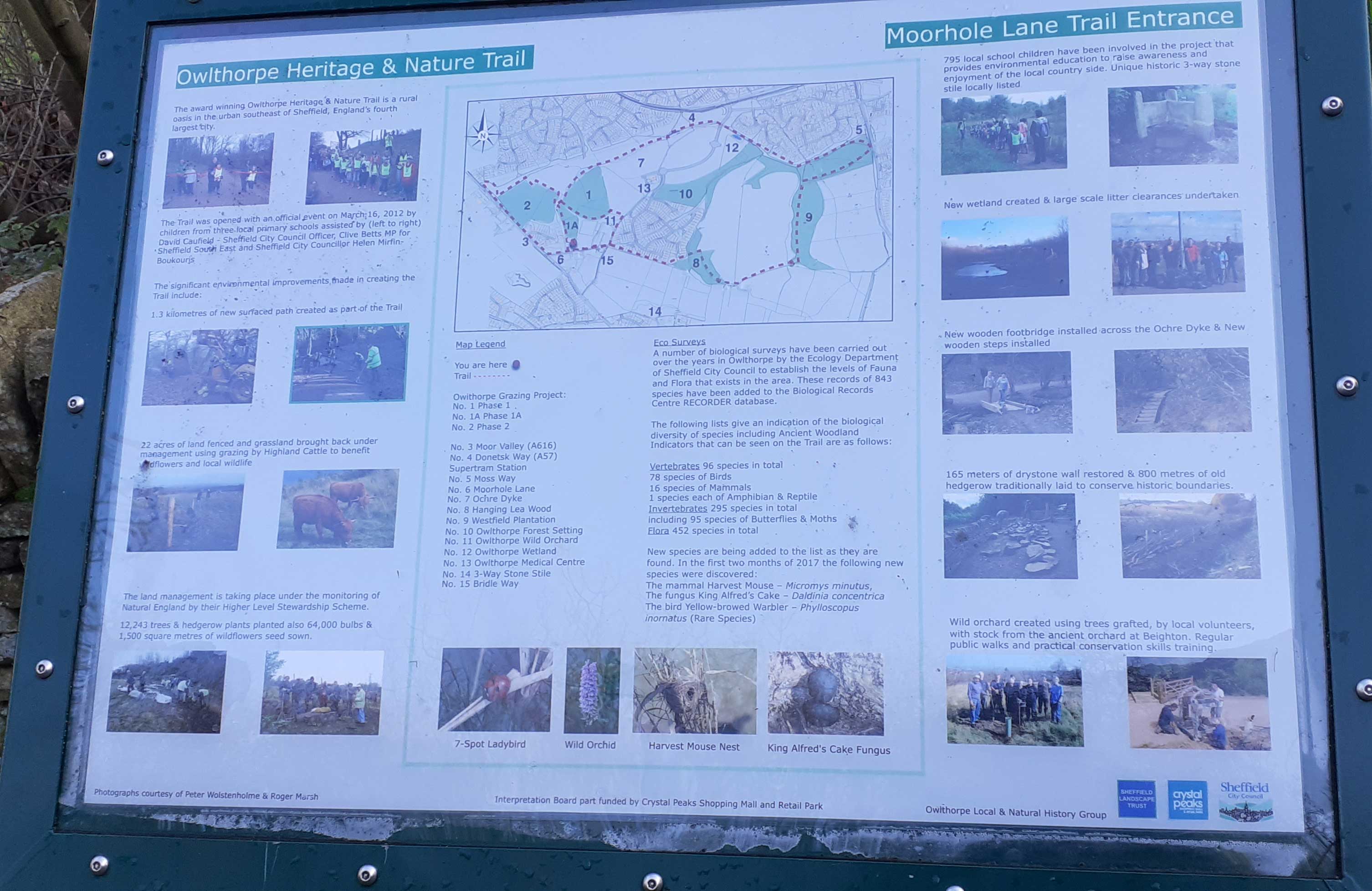
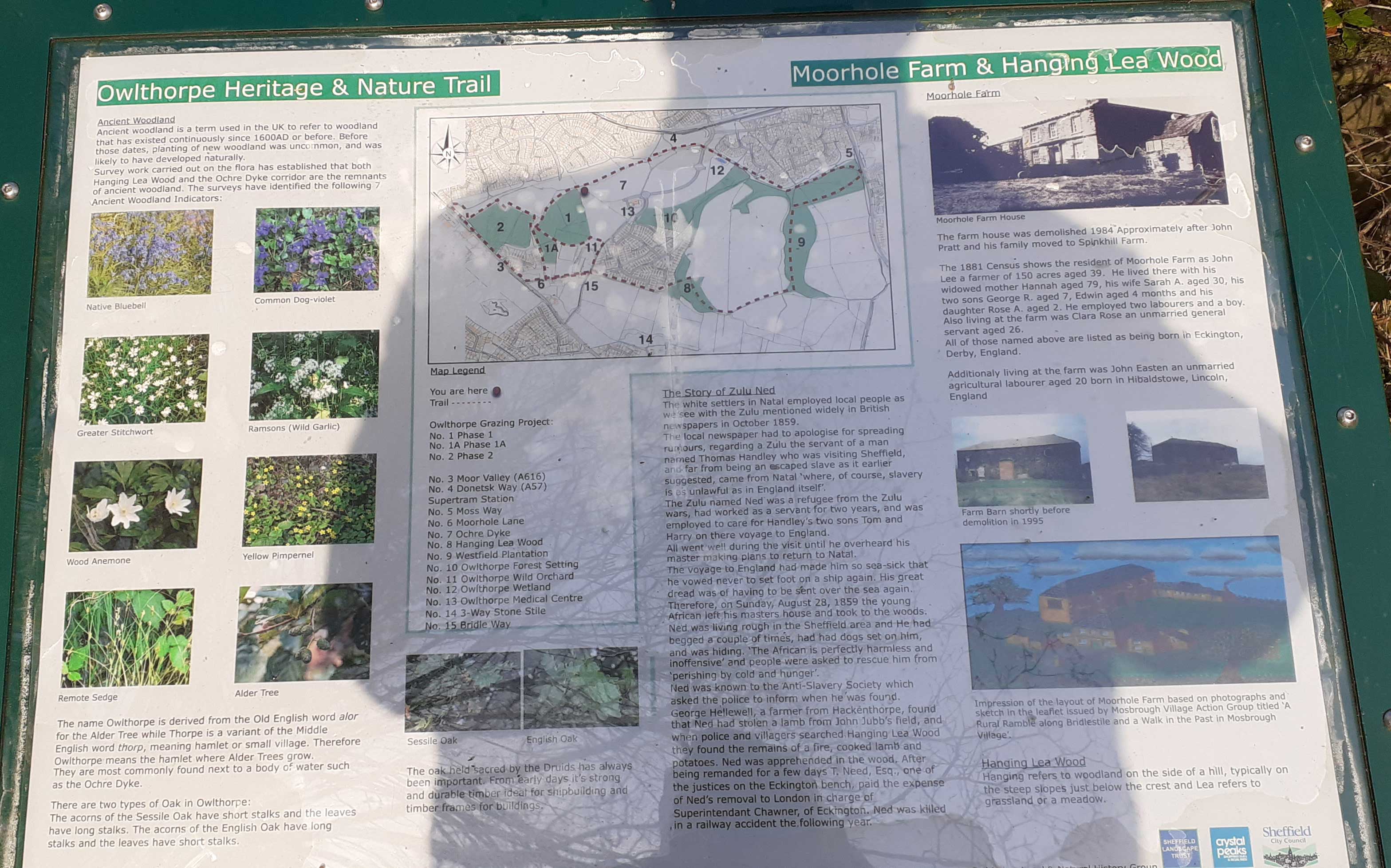
Interpretation Boards Our award-winning oasis was opened in 2012 by Clive Betts MP for Sheffield South East. The Land managment was undertaken and monitored by Natural England by their Higher-Level Stewardship Scheme. Some 795 local school children were involved in the project together with hundreds of members of the local community who now use the oasis on a regular basis. Thank you all who took part in this environmentaly friendly project. |
|
|
|
Approx: 453ft above sea level |
GPS Co-ordinates: 53.33581,-1.38114 |
----------------------------------------------------------------- |
|
|
|
Approx: 387ft above sea leavel |
GPS Co-ordinates: 53.33765,-1.38187 |
------------------------------------------------------------------------- |
|
 |
|
Approx: 407ft above sea Level |
GPS Co-ordinates: 53.33712,-1.38161 |
---------------------------------------------------------------------------------- |
|
 |
|
Approx: 346ft above sea leavel |
GPS Co-ordinatesn 53.33896,-1.38057 |
-------------------------------------------------------------------------- |
|
 |
|
Approx: 412ft above sea level |
GPS Co-ordinates: 53.33602,-1.37873 |
---------------------------------------------------------------------- The intrepretation Boards where part funded by Crystal Peaks Shopping Mall and Retail Park. Thank you so much. The boards are both informative and educational and are used on a daily basis ----------------------------------------------------------------------------- |
|
 |
|
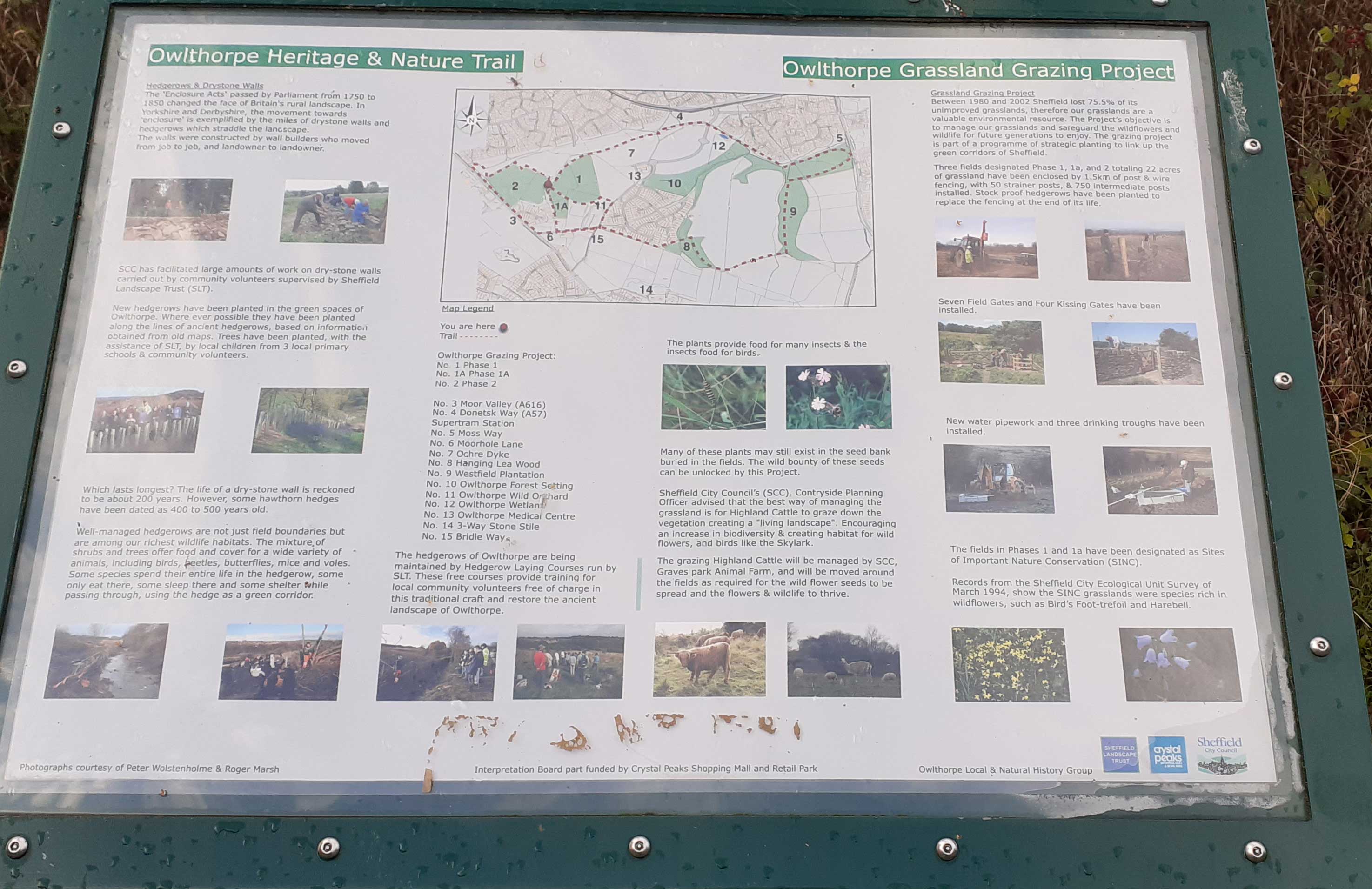
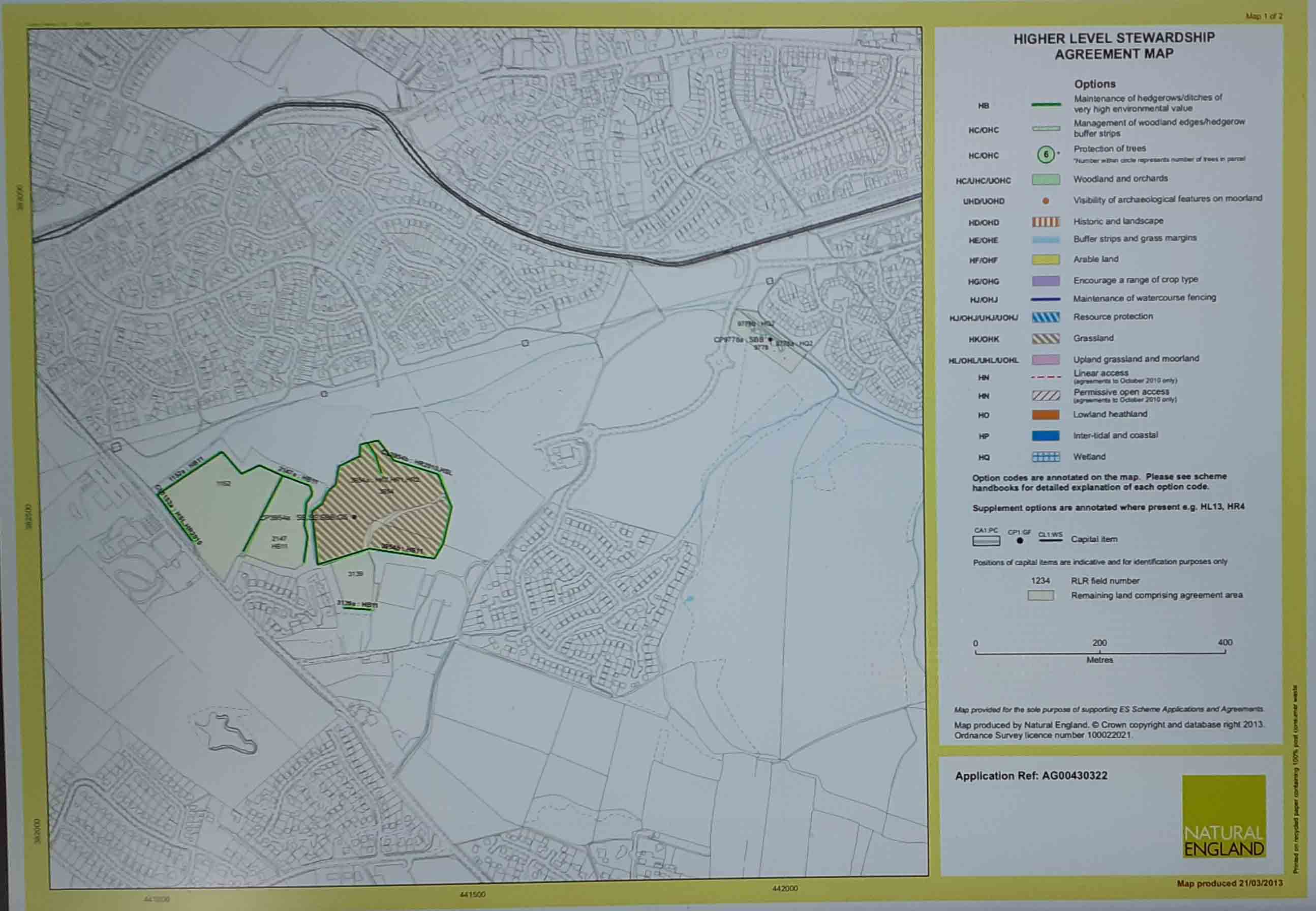
The Map shows the important areas of Maintenance of Hedgerows, Ditches, Grassland and Wetlands that are of very high environmental value. |
|
|
|
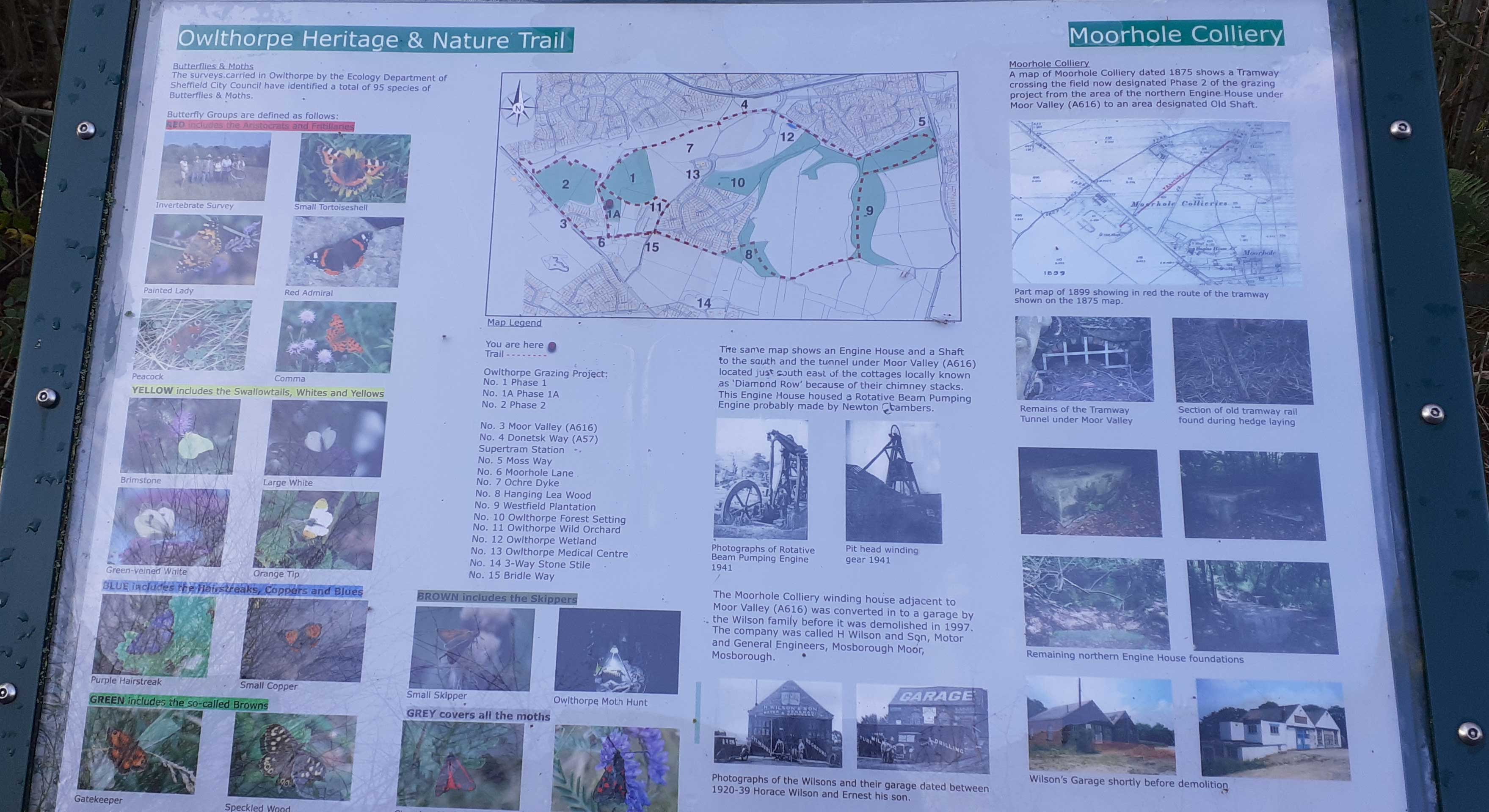
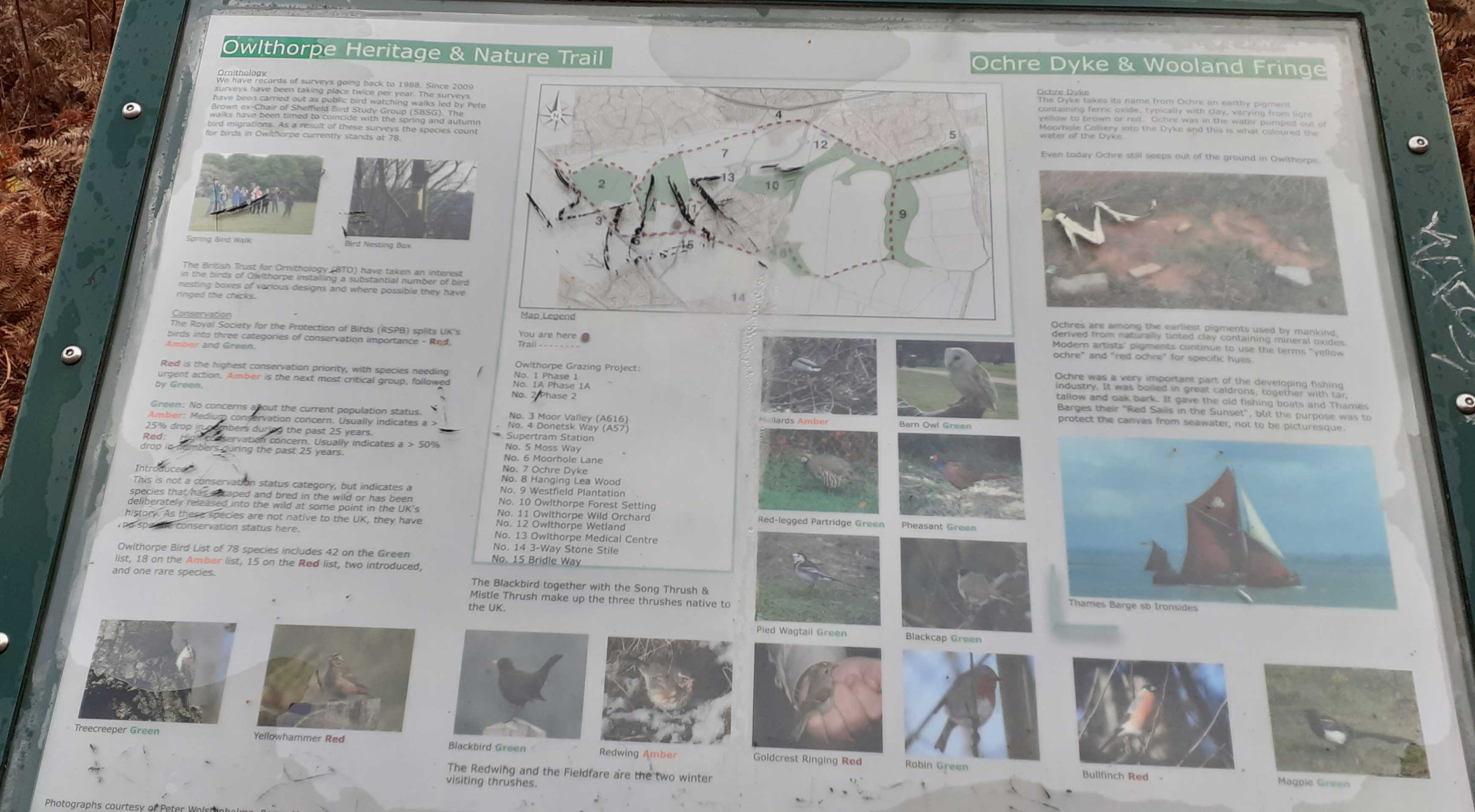
There are a number of organisations which can help with identification. Here are one or two web-sites you may find helpful. https://www.woodlandtrust.org.uk/blog/2019/07/butterfly-identification/ |
|