Welcome to our on-line Visitor's Guide to Friends of Ecological Owlthorpe
Updated Recently 16,409 views to date. Please SHARE on social media with friends and family
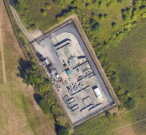
Click on the above wording to bring up a larger Google Map.
-------------------------------------------------------------------------
Dear reader,
- Please explore our on-line visitors guide to Friends of Ecological Owlthorpe. Scroll down the page to see points of interest.
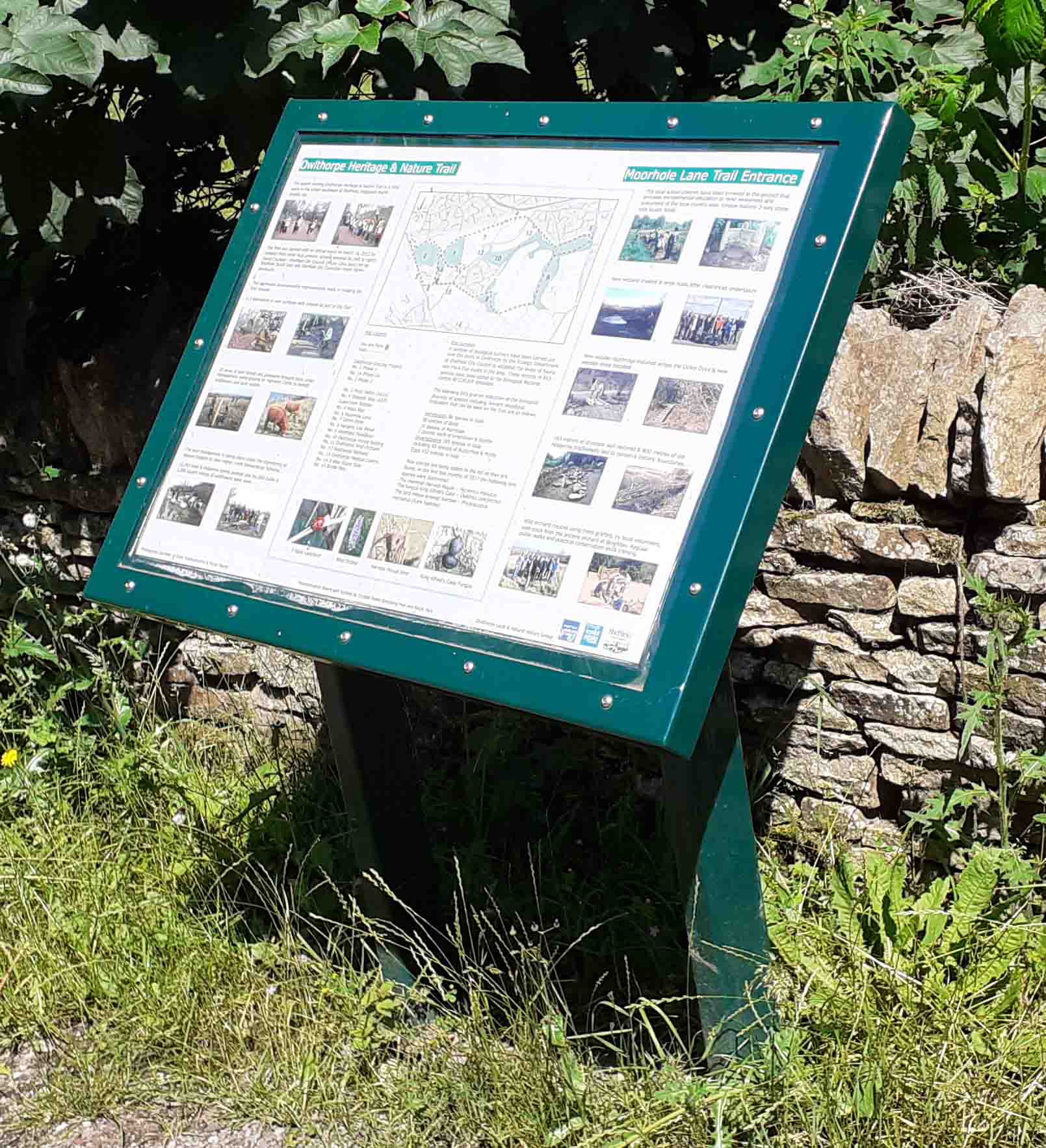
- If you double click on any of the interpretation board photos you will be able to view a large version, which enables you to read online, the extent of environmental work carried out in creating our oasis.
- To support the project, Government funding was provided by Natural England, under their higher-level stewardship agreement.
- The google maps show the GPS coordinates, which help if you decide you wish to visit in person.
- Many parents bring their children and use the interpretation boards to educate them about the wonderful environment we live in.
- Owlthorpe is very steep; some locations show the height above sea level.
- Scrolling down the page we have several short videos which you may find interesting.
- Please share with Friends & Family.
- Thank you for your attention
Michael Meredith
Please read our Mission statement |
(24) Watch the Video of Owlthorpe Nature Trail
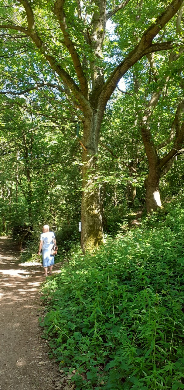
What a pleasure it is to enjoy a summers walk watching the squirrels at play as they run up and down the trees in Owlthorpe Heritage & Nature Trail
https://www.ecological-owlthorpe.org/owlthorpenaturetrails.htm
The area is used by dog walkers familys taking their children to enjoy the wonderful walks Owlthorpe Heritage & Nature Trail has to offer.
Approx.: 320ft Above sea level
GPS Co-ordinates 53.33988,-1.37676 |
(32) Grassland Servey's
Click on the photo to see the full report, regarding the vast quantity of invertebrate's living on phase 2 of the Grassland project.
https://www.ecological-owlthorpe.org/ecologicalserveys.html
Many species live in Phase 2 of the Grazing project all year round, some migrate to other areas. It is hard to believe how many species live in the Grasslands of Owlthorpe Heritage & Nature Trail.
https://www.ecological-owlthorpe.org/owlthorpegrassland.htm
GPS Co-ordinates 53.33798,-1.38319
|
(3) Coal Mining in Owlthorpe
https://www.ecological-owlthorpe.org/dentandmoorholecolleries.htm
There are a number of coal seams running under Owlthorpe: Sitwell Thin Coal, Sitwell, Rawmarsh and Silkstone. History shows that coal in Owlthorpe has been mined by a number of pits including the Birley group of pits. Brook Lane Opencast mine:
.Double click on the (Notice Board) to obtain a large on-line readable version of the interpretation Board regarding
Approx.: 407ft Above sea level
GPS Co-ordinates 53.33712,-1.381610 |
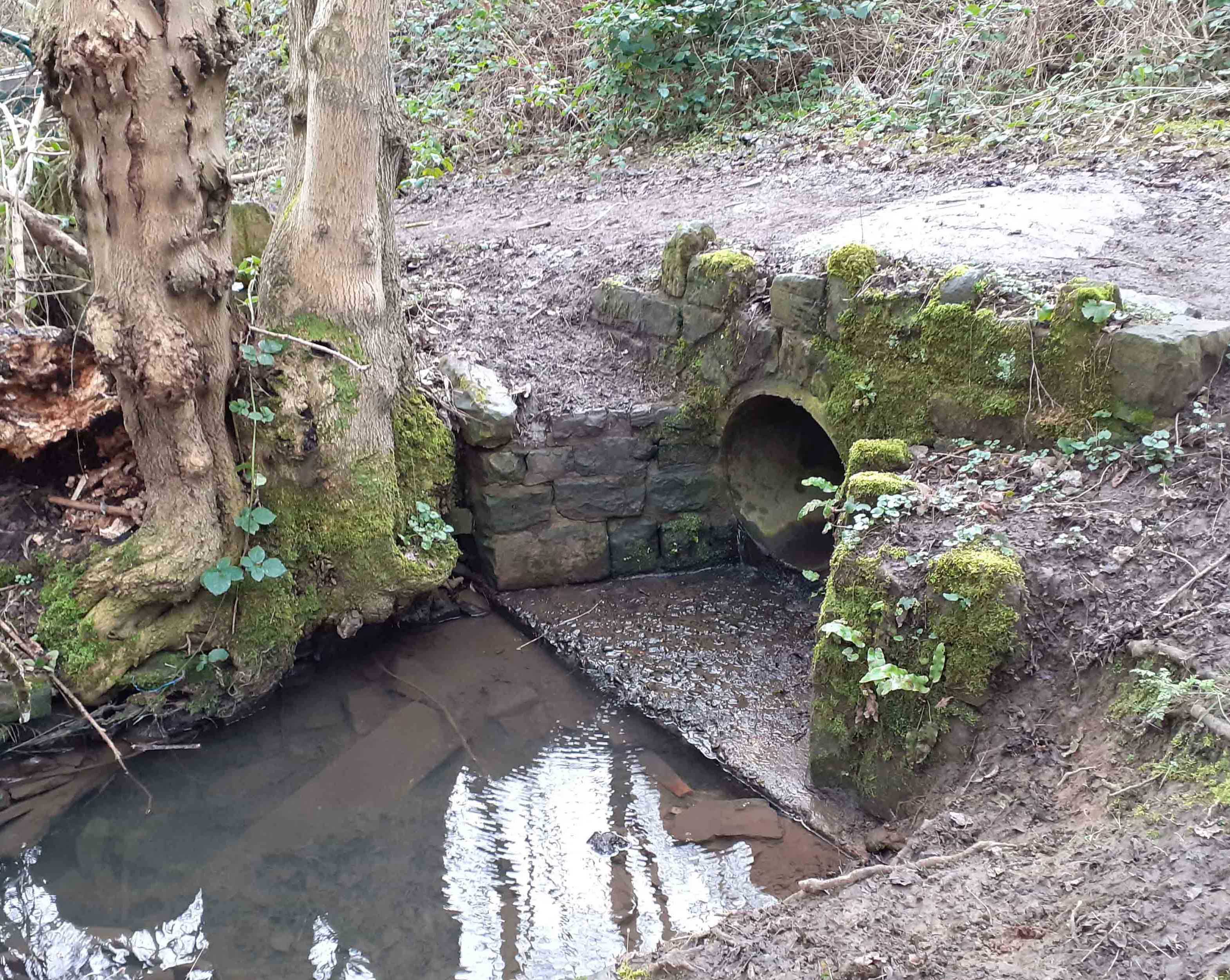
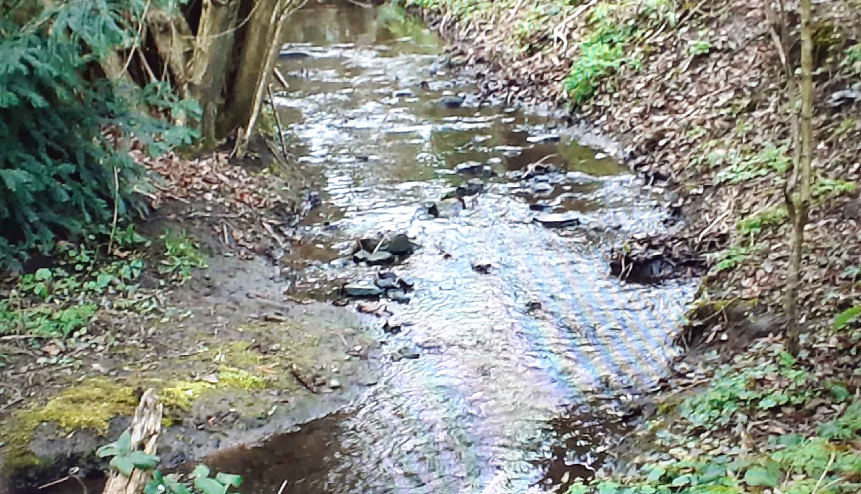
(47) Video of Culvert
https://www.ecological-owlthorpe.org/Colvert%202.mp4
The culvert carries water under Moor Valley from the header waters of the Ochre Dyke which is situated in Birley Woods at the side of the Golf course.
The Ochre Dyke passes close to the Birley Moor Pit. When in operation water had to be pumped out to stop the miners from drowning. It is the Ochre from the pits that gives the Ochre Dyke its name.
Approx: 420ft above sea Level
GPS Co-ordinates 53.33822,-1.385700
|
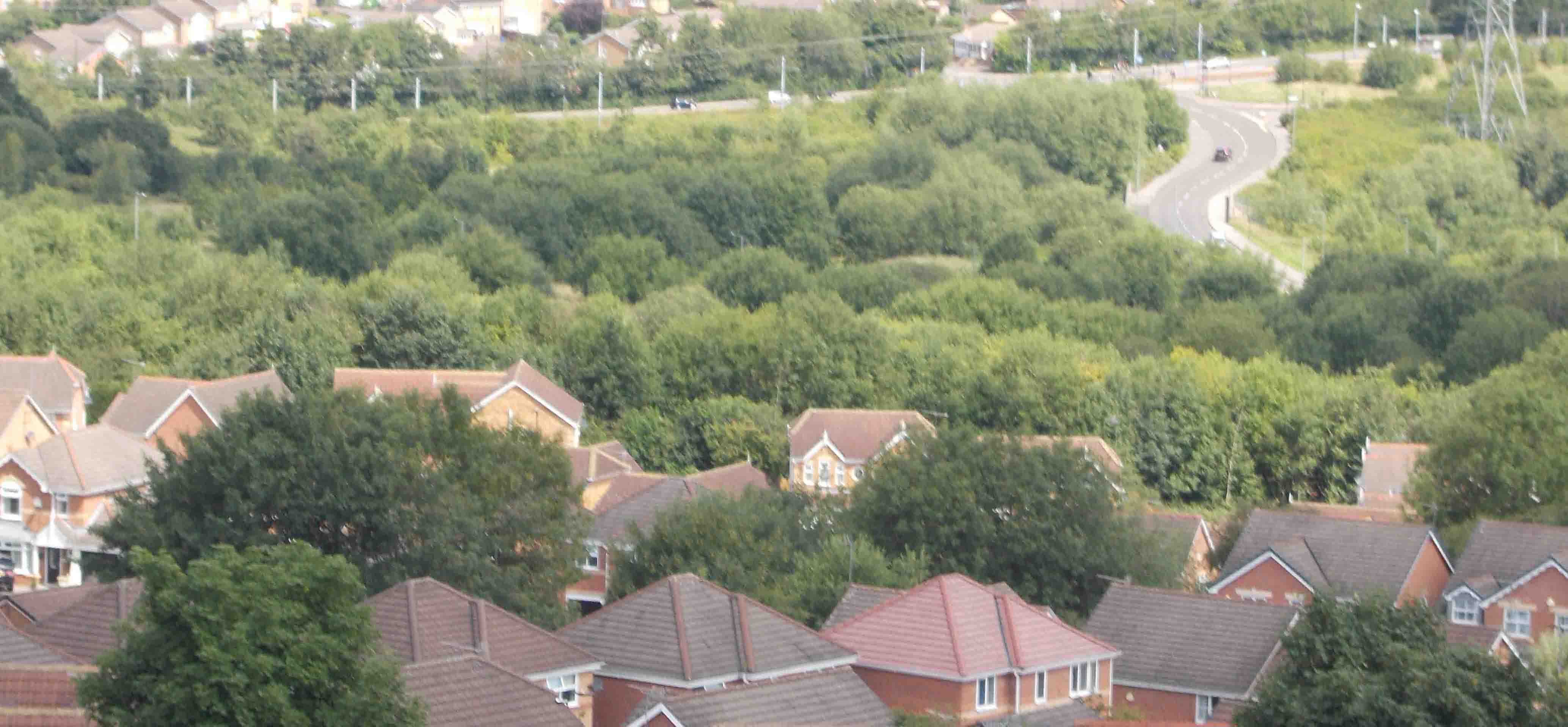
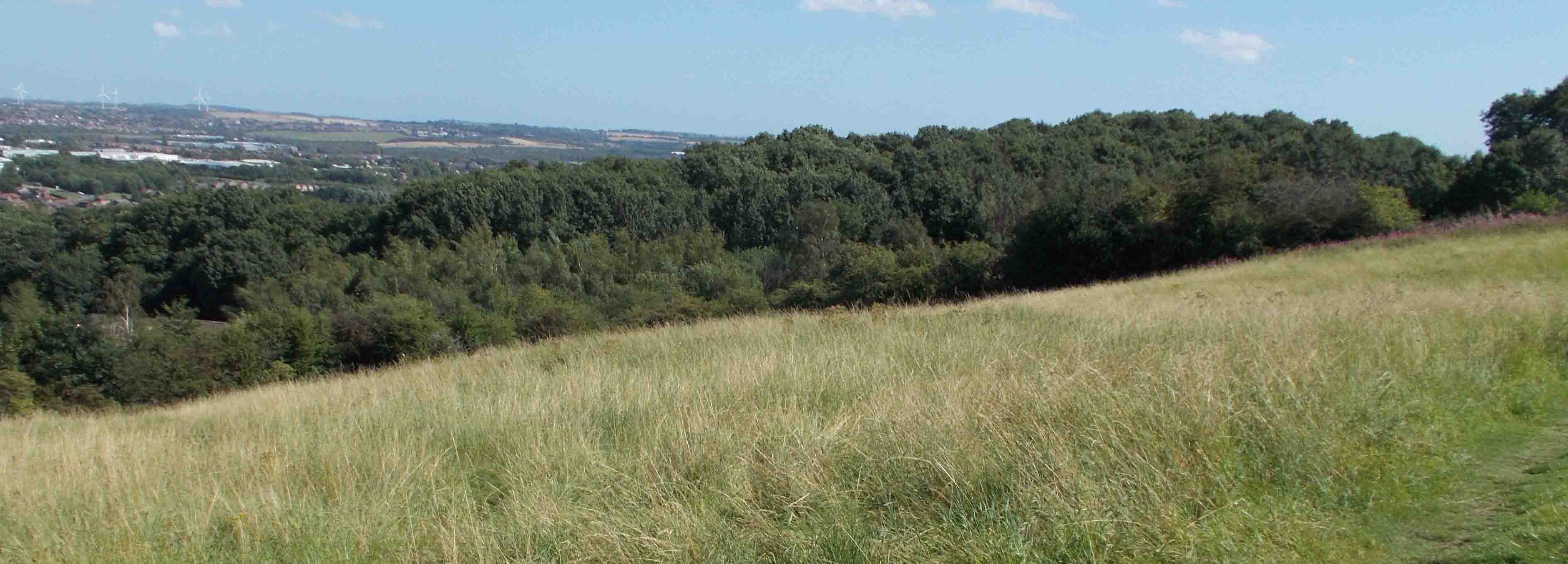
(38) Looking across Owlthorpe Fields
You can see that the field has completely rewilded, bosting many maturing trees.
https://www.ecological-owlthorpe.org/owlthorpefields.htm
Approx.: 307ft Above sea level
GPS Co-ordinates 53.33418,-1.37085
|
(29) Ochre Dyke Opposite Royston Av.
.Water cascades off the Grazing project and joins the Ochre Dyke opposite Royston Av. Some of the water is washed underground, the rest continues down the mainstream.
https://www.ecological-owlthorpe.org/Grassland%20Runof%20Watre.mp4
Approx.: 378ft above sea level.
GPS Co-ordinates 53.33933,-1.38263
|
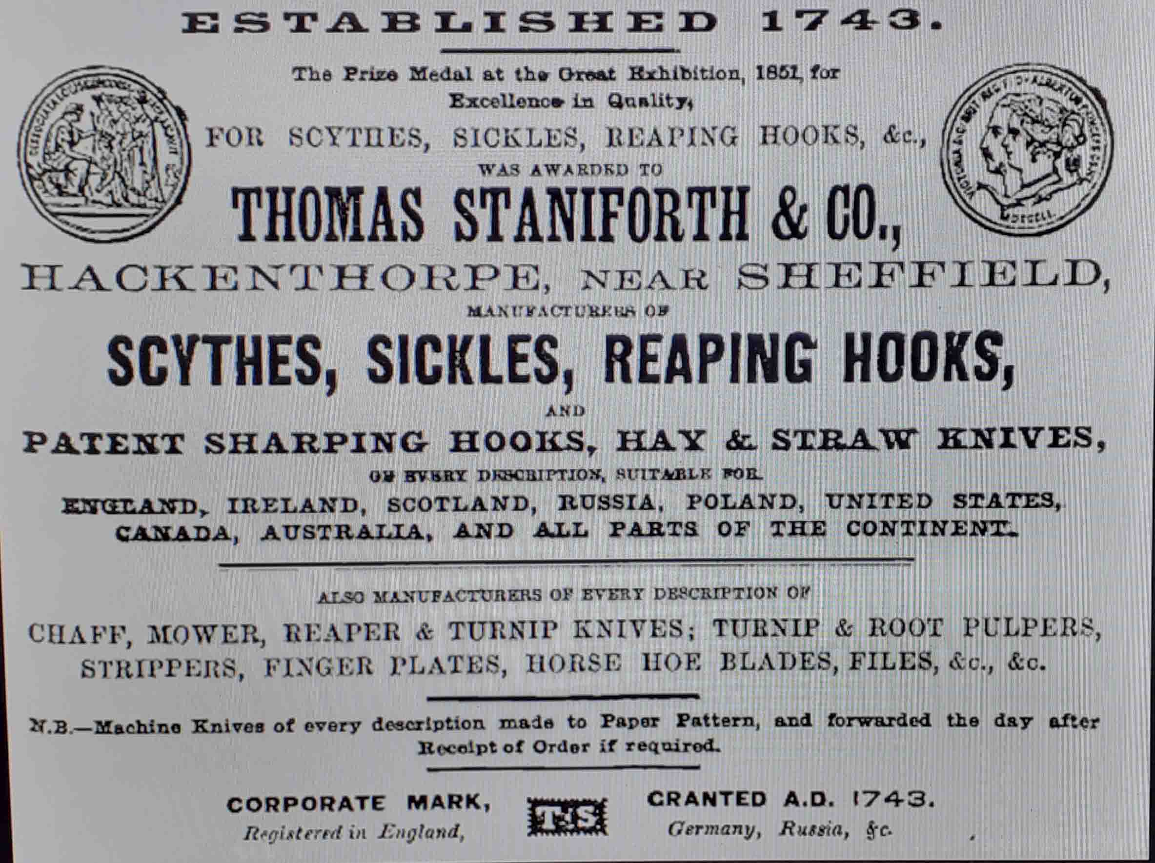
(51) Owlthorpe History
Thomas Staniforth & Co. was a sickle, scythe tool smiths based in Hackenthorpe, Sheffield, England. The company was founded by Thomas Staniforth in 1743 and operated out of workshops located on Main Street, Hackenthorpe
https://www.ecological-owlthorpe.org/moorholelane.htm
Trees in Owlthorpe were coppiced to make charcoal for the kilns that manufactured Sickles & Scythes, to support the farming industry.
Thomas Staniforth won the Prize Medal at The Great Exhibition 1851, for excellence in quality.
|
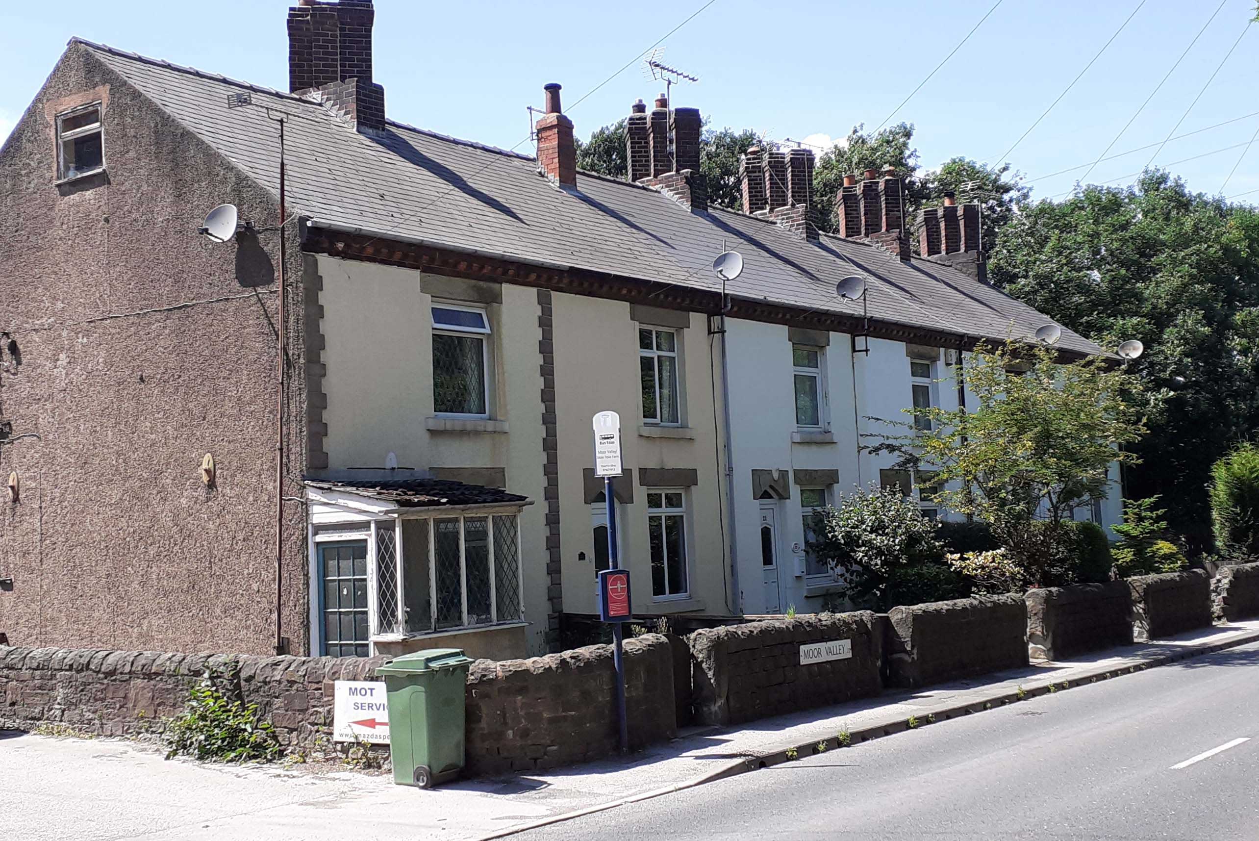
(36) Dimond Cottages
Many of the miners that worked down the pits lived in the cottages. The cottages got their name from the diamond shaped window pains.
The cottages remain just the same as they where when the miners lived their.
Approx.: 423ft above sea Level
GPS Co-ordinates 53.33765,-1.385460
|
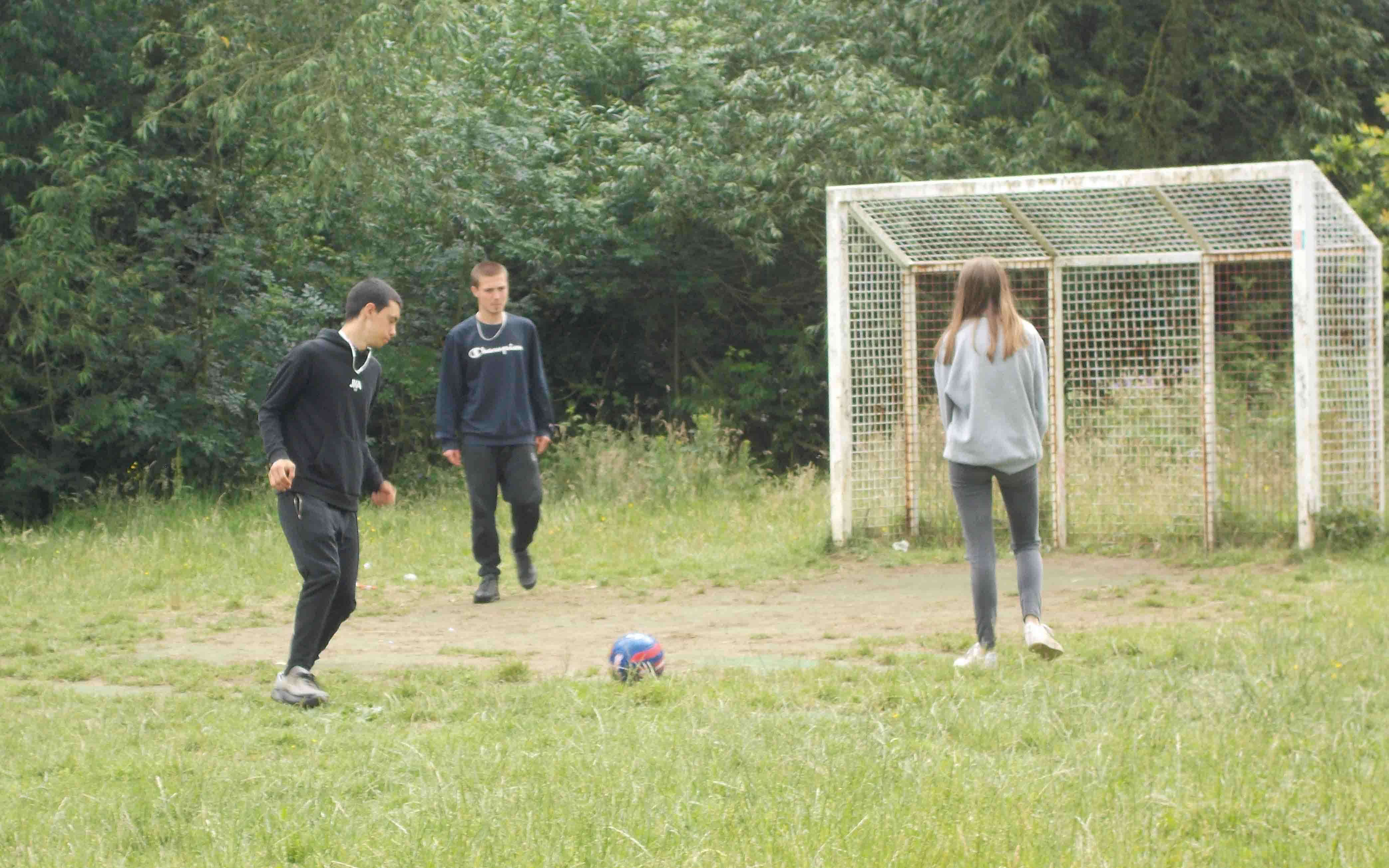
(8) Owlthorpe Forest Settings.
Kids playing football on the recreation grownd.
https://www.ecological-owlthorpe.org/owlthorpeforestsettings.htm
Aprox: 266ft above sea level
GPS Co-ordinates 53.33949,-1.37062 |
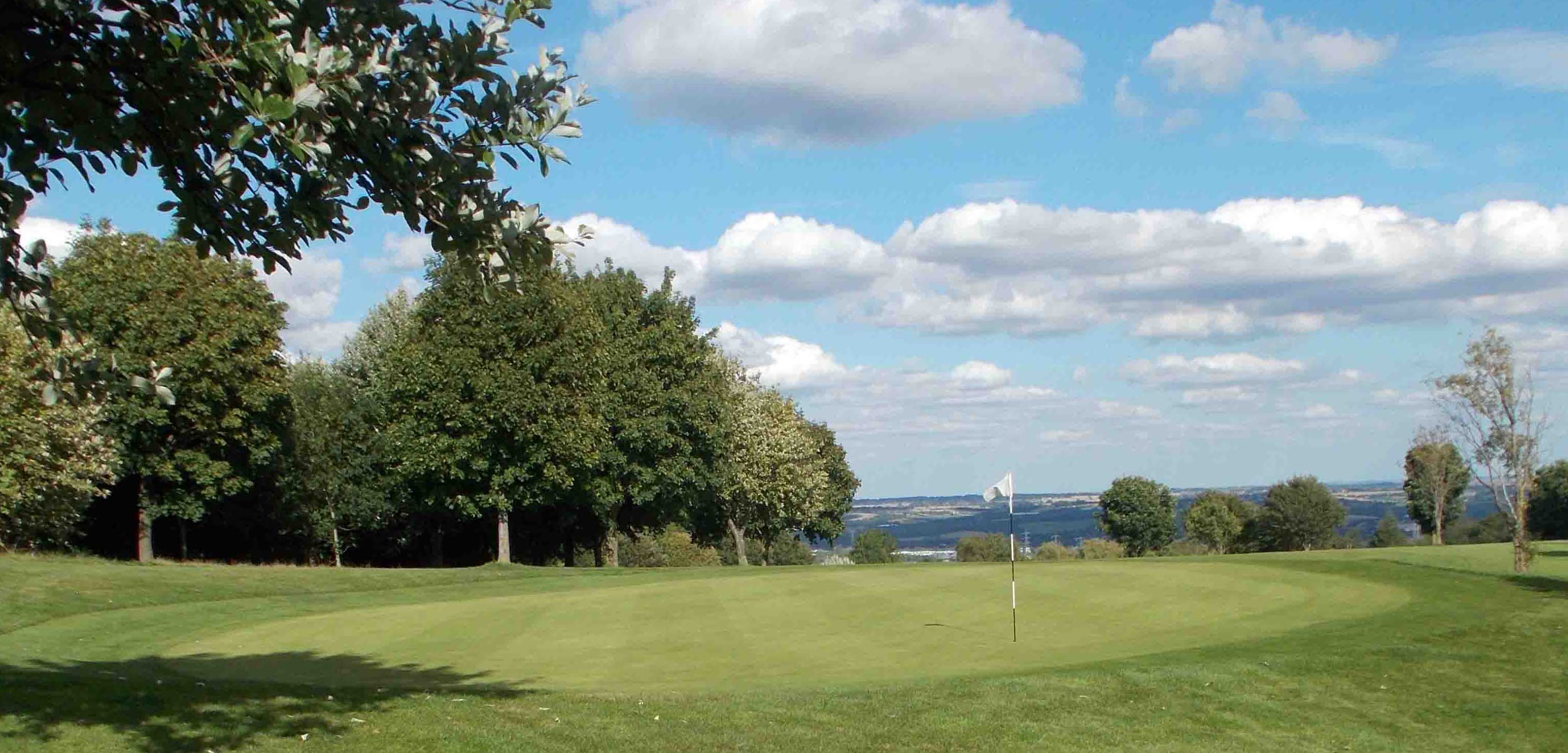
(49) Birley Wood Golf Course
https://www.sheffieldcitytrust.org/venues/birley-wood-golf-course
The greens are well managed. There are many mature trees which enhance the look of the fairways.
This photo was taken from the 15th. There is a good view of the valley in the distance.
Approx.: 650ft above sea Level
GPS Co-ordinates 53.33975,-1.402474
|
() Hanging Lea Wood
https://www.ecological-owlthorpe.org/hangingleawood.htm
There are some spectacular views looking over Hanging Lea Wood.
Hanging Lea refers to woodland on the side of a hill, typically on the steep slopes just below the crest and the Lea refers to grassland or a meadow.
Approx: 475Ft above sea Level
GPS Co-ordinates 53.33437,-1.376210
|
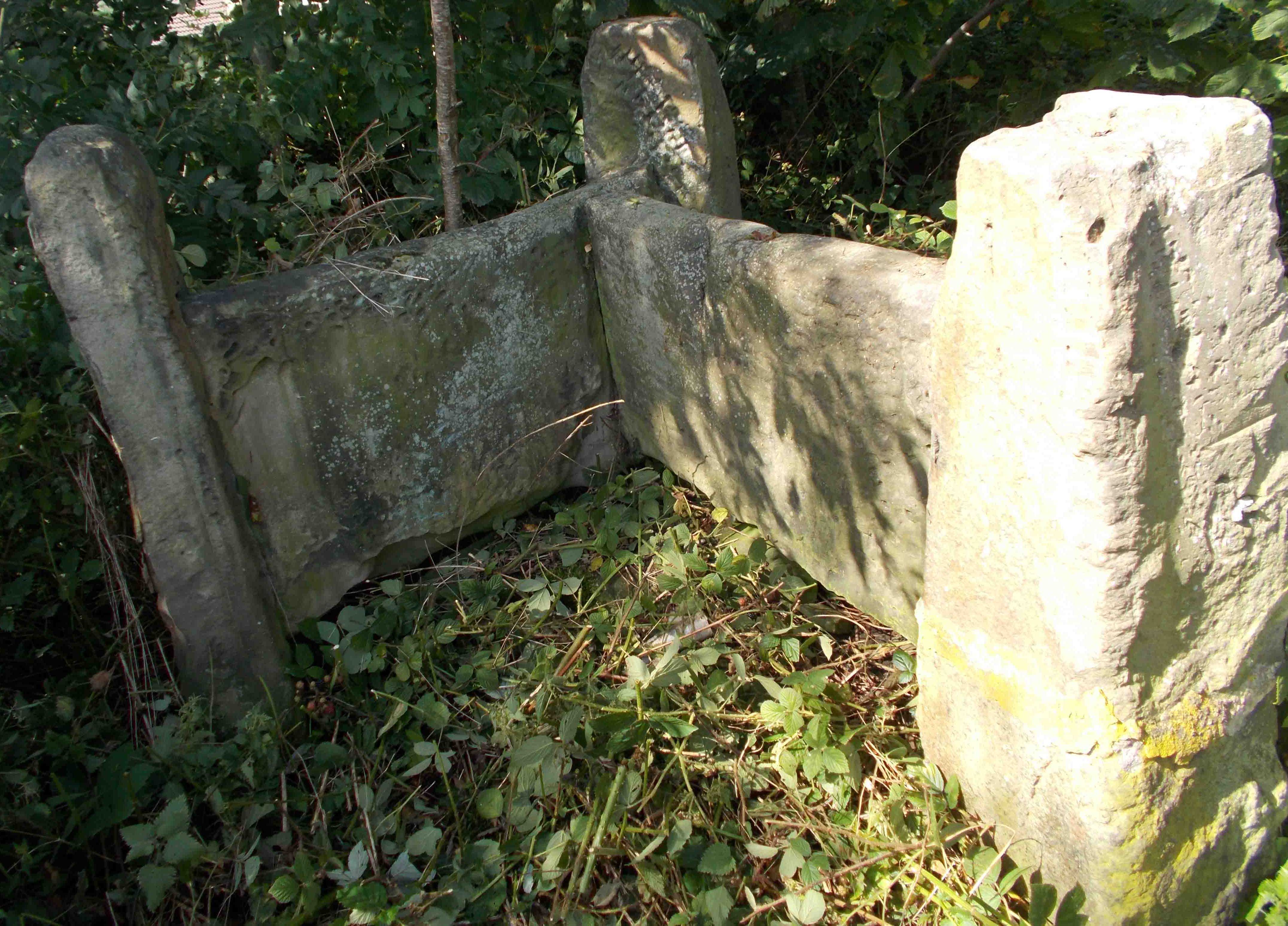
(6) 3 Way Stile
Quite a hike up the hill but the views are spectacular. The stables for the pones that worked down the pits were housed at the side of the stile. Ponies were taken acros Owlthorpe to the blacksmith at Hackenthorpe to be re-shod.
Approx: 502ft above sea Level
GPS Co-ordinates 53.33296,-1.37566
|
|
|
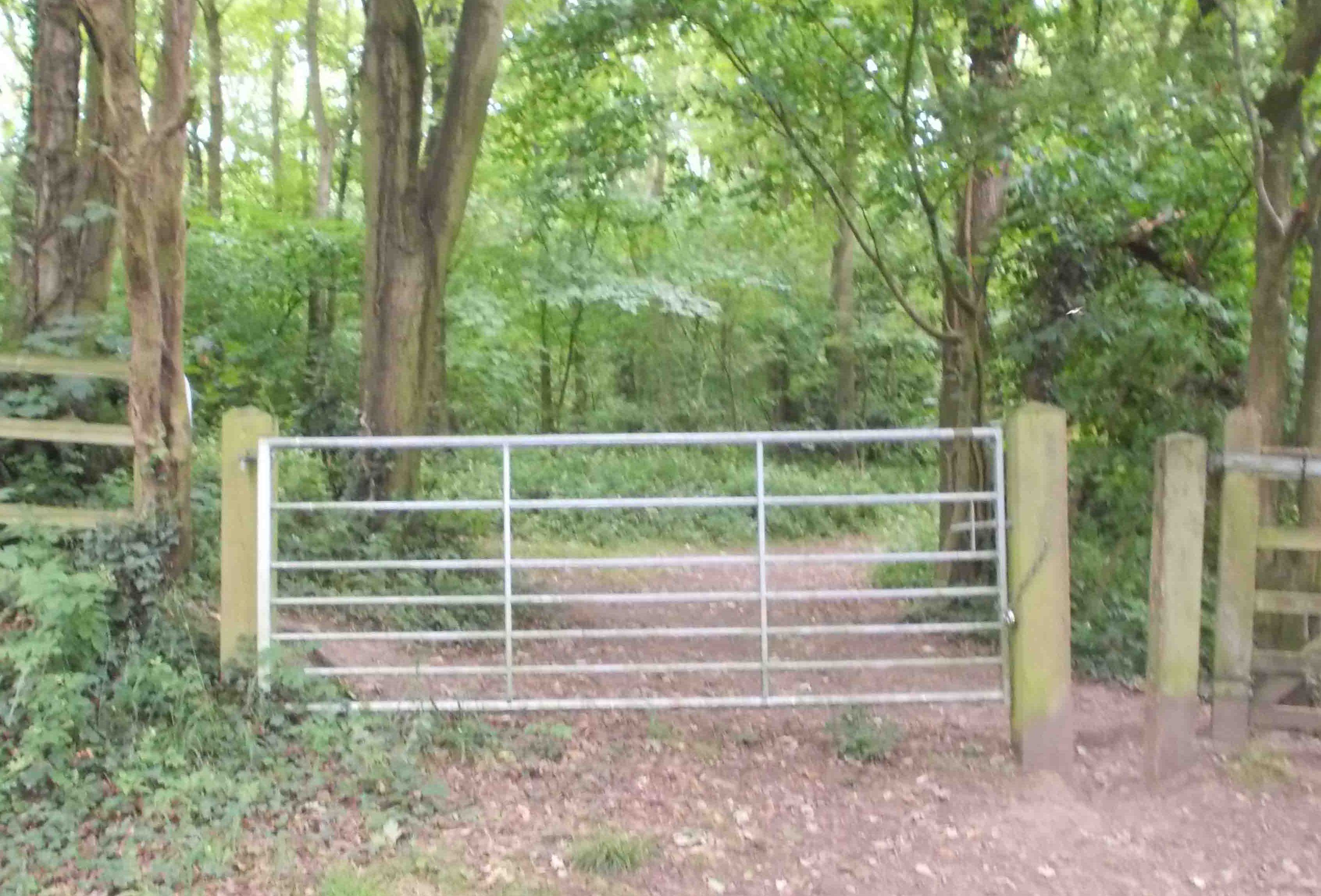
(10) Westfield Plantation (Gate)
https://www.ecological-owlthorpe.org/westfieldplantation.htm
The plantation boasts many types of trees and is a haven for Owls.
Approx.: 258ft Above sea level
GPS Co-ordinates 53.33828,-1.36697 |
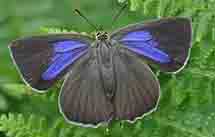
(59) Buttterflies living in Ecological Owlthorpe
https://www.ecological-owlthorpe.org/butterflies.htm
There are many butterfly species that live and can be seen almost anywhere in Ecological Owlthorpe. On the many public footpaths from the Grasslands of the Grazing Project & throughout the woodlands
|
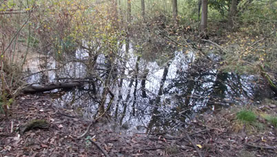
(14) Owlthorpe Wetlands
https://www.ecological-owlthorpe.org/owlthorpewetlands.htm
The Owlthorpe Wetland was created as part of the overall project to support and enhance the ecology of Owlthorpe.
The wetlands have been neglected and are completely overgrown.
Approx: 260ft above sea Level
GPS Co-ordinates 53.34012,-1.37069 |
|
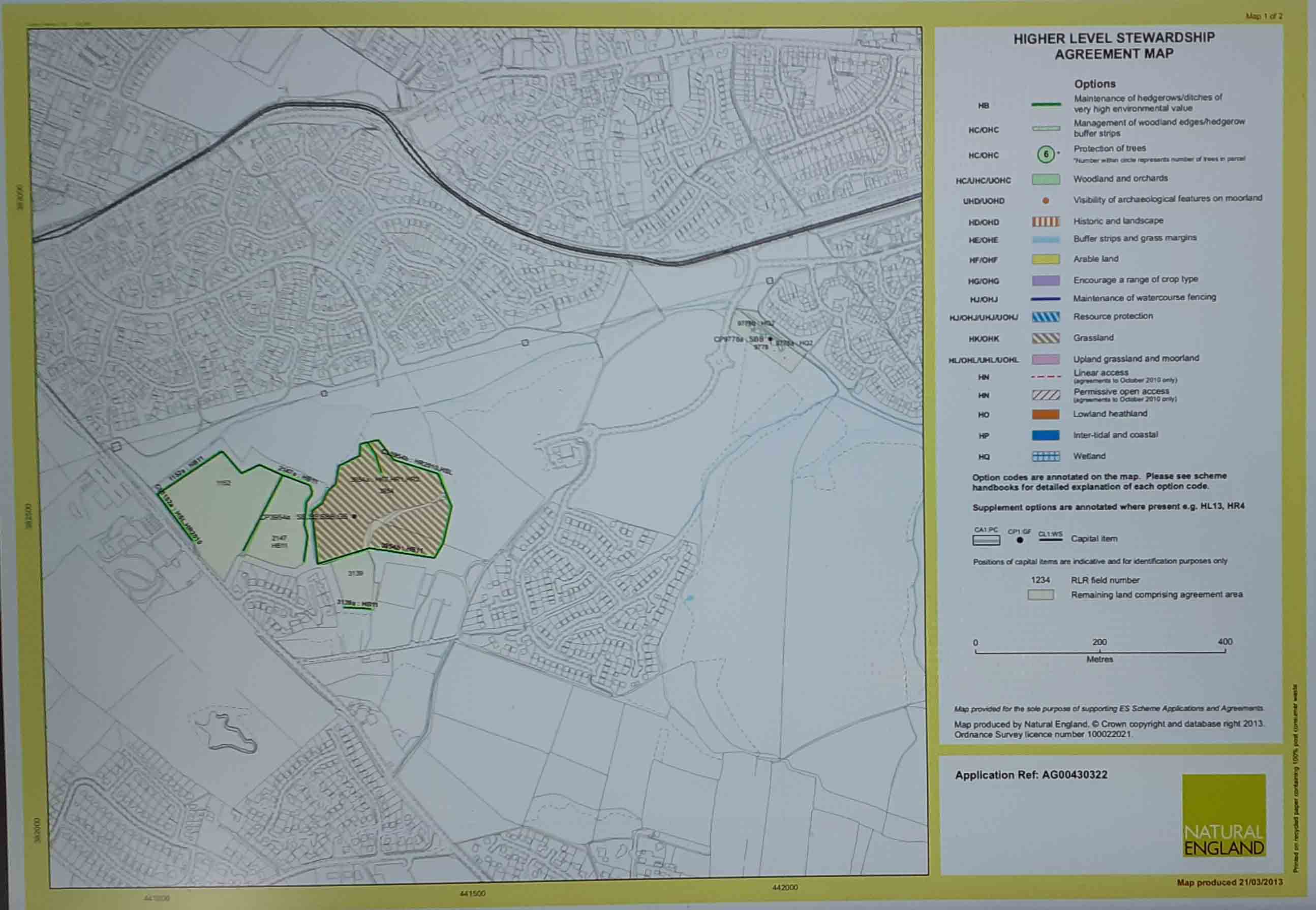
(50) Hedgerows.
https://www.ecological-owlthorpe.org/HigherLevelStwardshipAgreementMap.pdf
The Higher-level Stewardship map shows the exact location of all the hedgerows of very high environmental value in Owlthorpe. New hedgerows have been planted in the green spaces of Owlthorpe. Wherever possible they have been planted along the lines of ancient hedgerows, based on information obtained from old maps. Trees have been planted, with the assistance of SLT, by local children from 3 local primary schools & community volunteers.
|
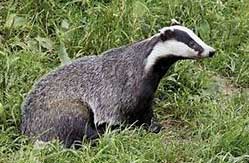
(61) Mammals roaming Ecological Owlthorpe
https://www.ecological-owlthorpe.org/mammals.htm
There are many mammals living in Ecological Owlthorpe although we do not see as many as we used to. Badgers are no longer seen in the numbers that used to roam the woodlands but they have been seen recently in Owlthorpe Wild Orchard and Owlthorpe Fields which is still their natural habitat
|
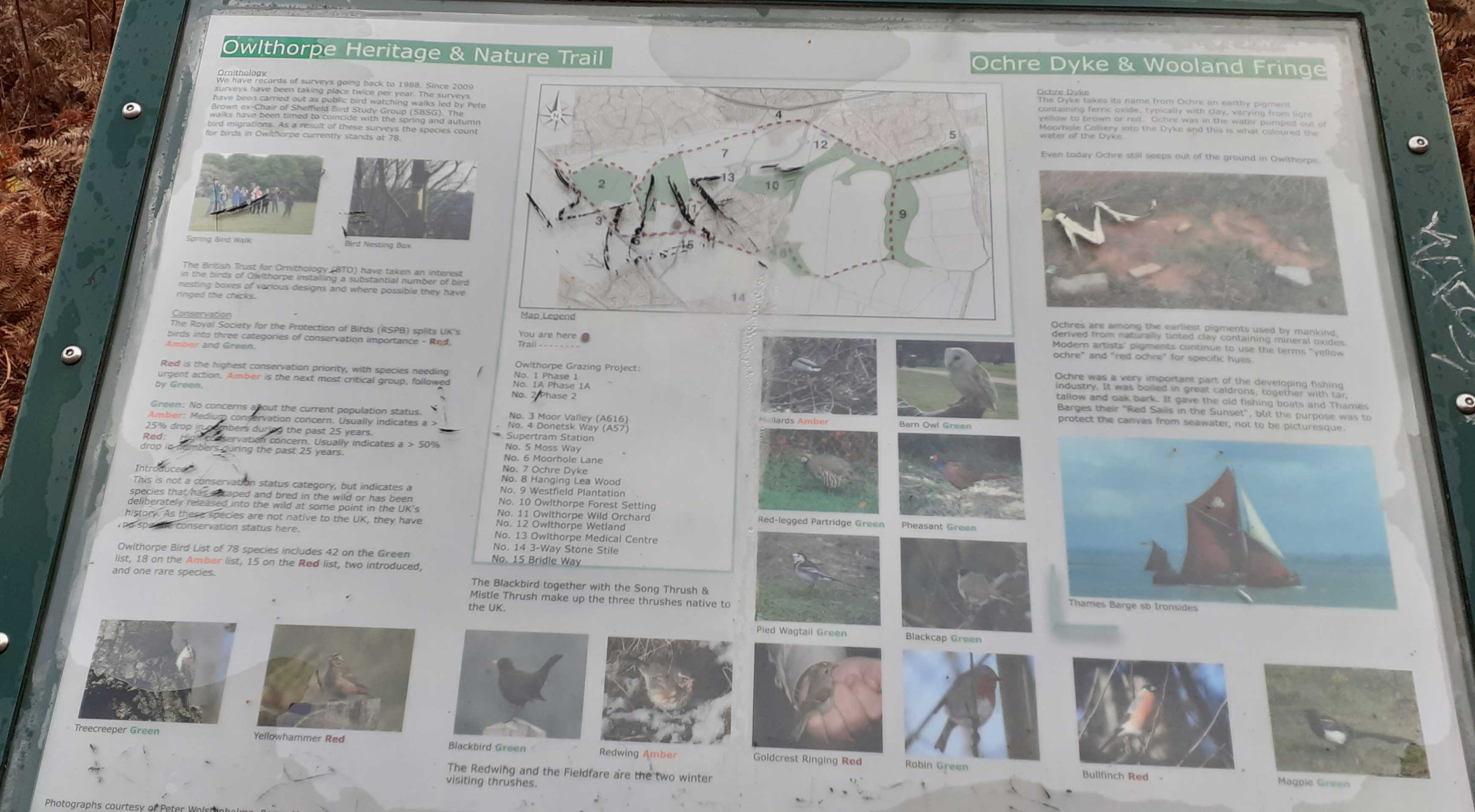
(1) Double click on the (Notice Board) to obtain a large on-line readable version of the interpretation Board regarding Owlthorpe Heritage
https://www.ecological-owlthorpe.org/owlthorpenaturetrails.htm
The British Trust has records of surveys going back to 1988. The walks have been timed to coincide with the spring and autumn bird migrations. As a result of these surveys the species count for birds in Owlthorpe is 78.
Approx.: 346ft Above sea level
GPS Co-ordinates 53.3389,-1.38056 |
(37) Header Waters of the Ochre Dyke are situated in Birley woods at the side of the Golf cause.
As children we explored Birley Woods, in the header waters of The Ochre Dyke we found frogspawn, tadpoles, frogs and newts.
Approx. 648ft above sea level.
GPS Co-ordinates 53.336862,-1.394311
|
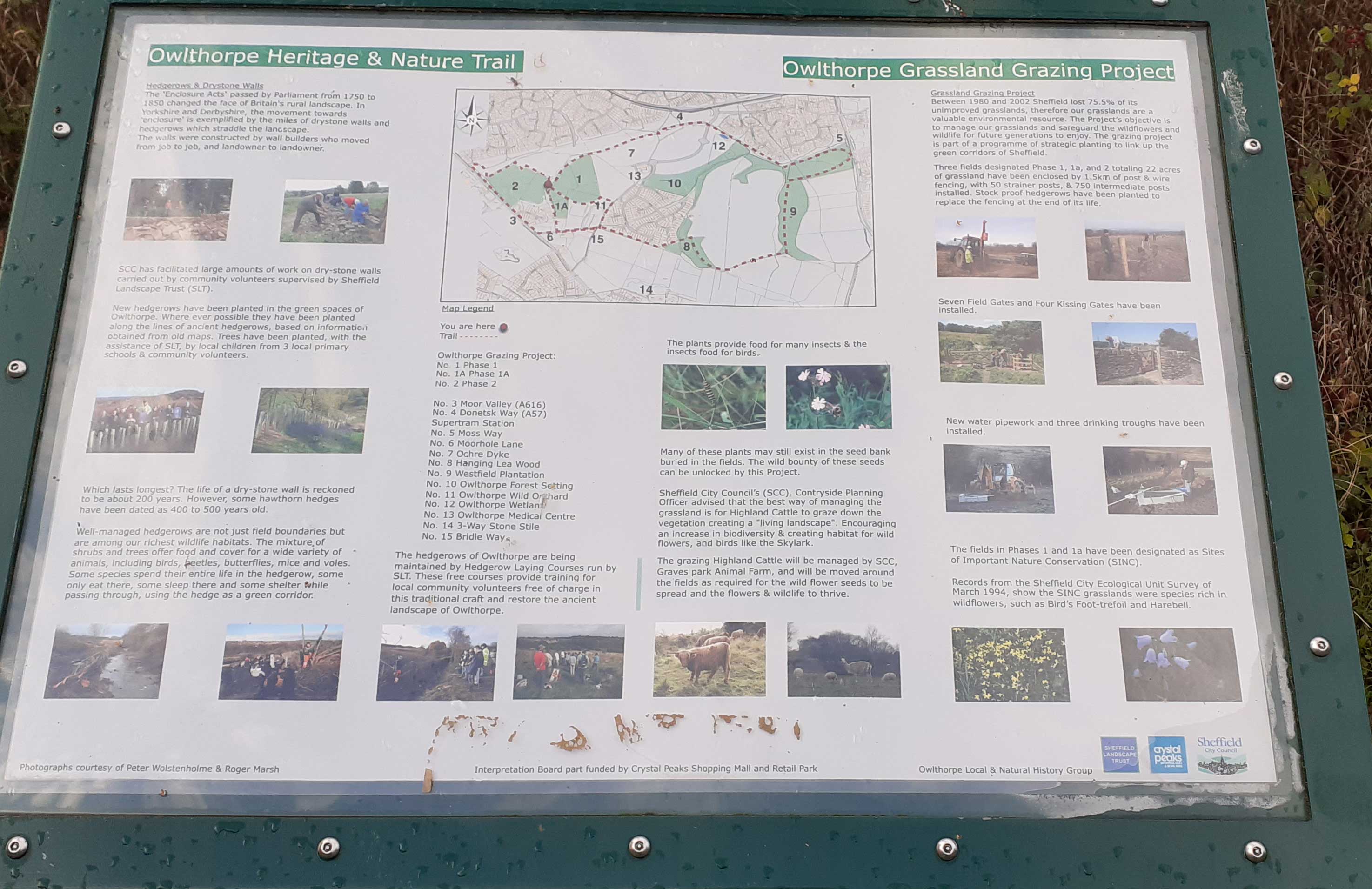
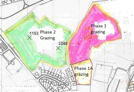
(2) Double click on the (Notice Board) to obtain a large on-line readabe version of the interpretation Board regarding the Grazing Project.
https://www.ecological-owlthorpe.org/owlthorpegrassland.htm
You can read in detail the project's objective is to manage our grassland and safeguard the wildflowers and wildlife for future generations to enjoy. The grazing project is part of a program of strategic planting to link up the green corridors of Sheffield.
Approx.: 387ft above sea Level
GPS Co-ordinates 53.33765,-1.38189 |
() Owlthorpe Flora
https://www.ecological-owlthorpe.org/flora.htm
The name Owlthorpe is derived from the Old English word "alor" for the Alder Tree while Thorpe is a variant of the Middle English word thorp, meaning hamlet or small village.
|
(3) Coal Mining in Owlthorpe
https://www.ecological-owlthorpe.org/dentandmoorholecolleries.htm
There are a number of coal seams running under Owlthorpe: Sitwell Thin Coal, Sitwell, Rawmarsh and Silkstone. History shows that coal in Owlthorpe has been mined by a number of pits including the Birley group of pits. Brook Lane Opencast mine:
.Double click on the (Notice Board) to obtain a large on-line readable version of the interpretation Board regarding
Approx.: 407ft Above sea level
GPS Co-ordinates 53.33712,-1.381610 |
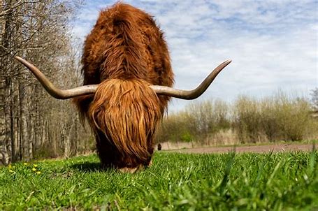
(33) Highland Cattle
Highland Cattle and other animals such as alpaca's can sometimes be seen on the Grazing plot 2 in Owlthorpe Heritage & Nature Trail.
GPS Co-ordinates 53.33764,-1.38254 |
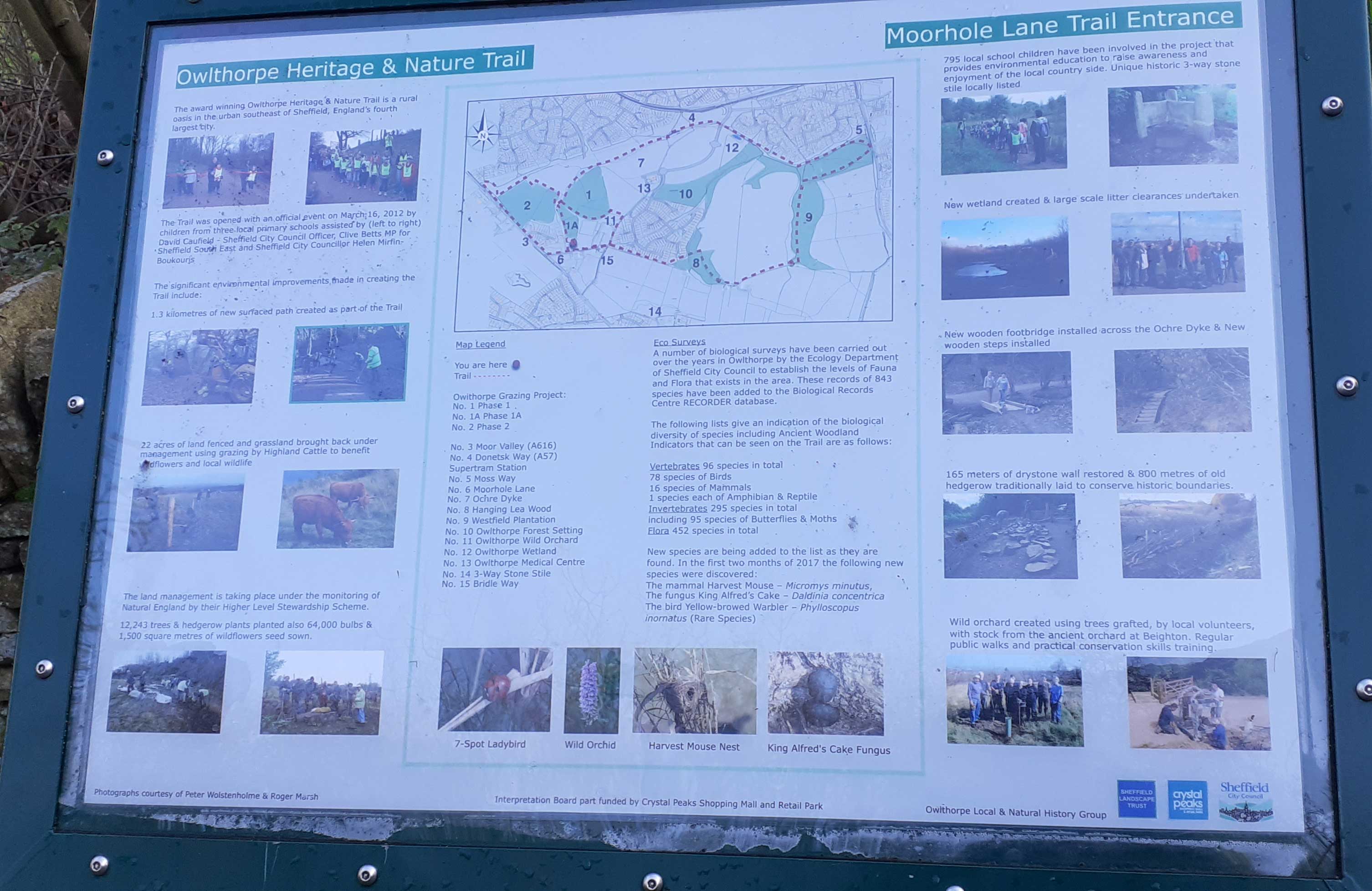
(4) Moor Hole Lane
https://www.ecological-owlthorpe.org/moorholelane.htm
795 Local school children were involved in the project that provides environmental education to raise awareness and enjoyment of the local countryside.
Double click on the (Notice Board) to obtain a large on-line readable version of the interpretation Board regarding Moor Hole Lane
Approx: 453ft above sea Level
GPS Co-ordinates 53.33588,-1.38116 |
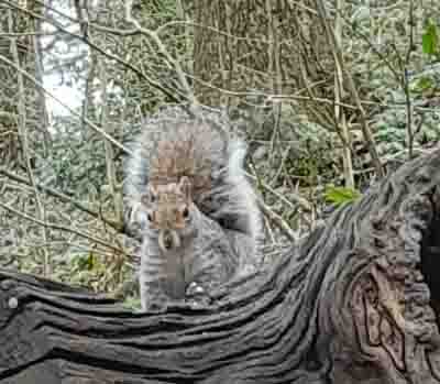
(23) Squirrel
The squirrels in Owlthorpe are very friendly this one decided to let me take his photo
Approx.: 307ft above sea level
GPS Co-ordinates 53.33998,-1.37624 |
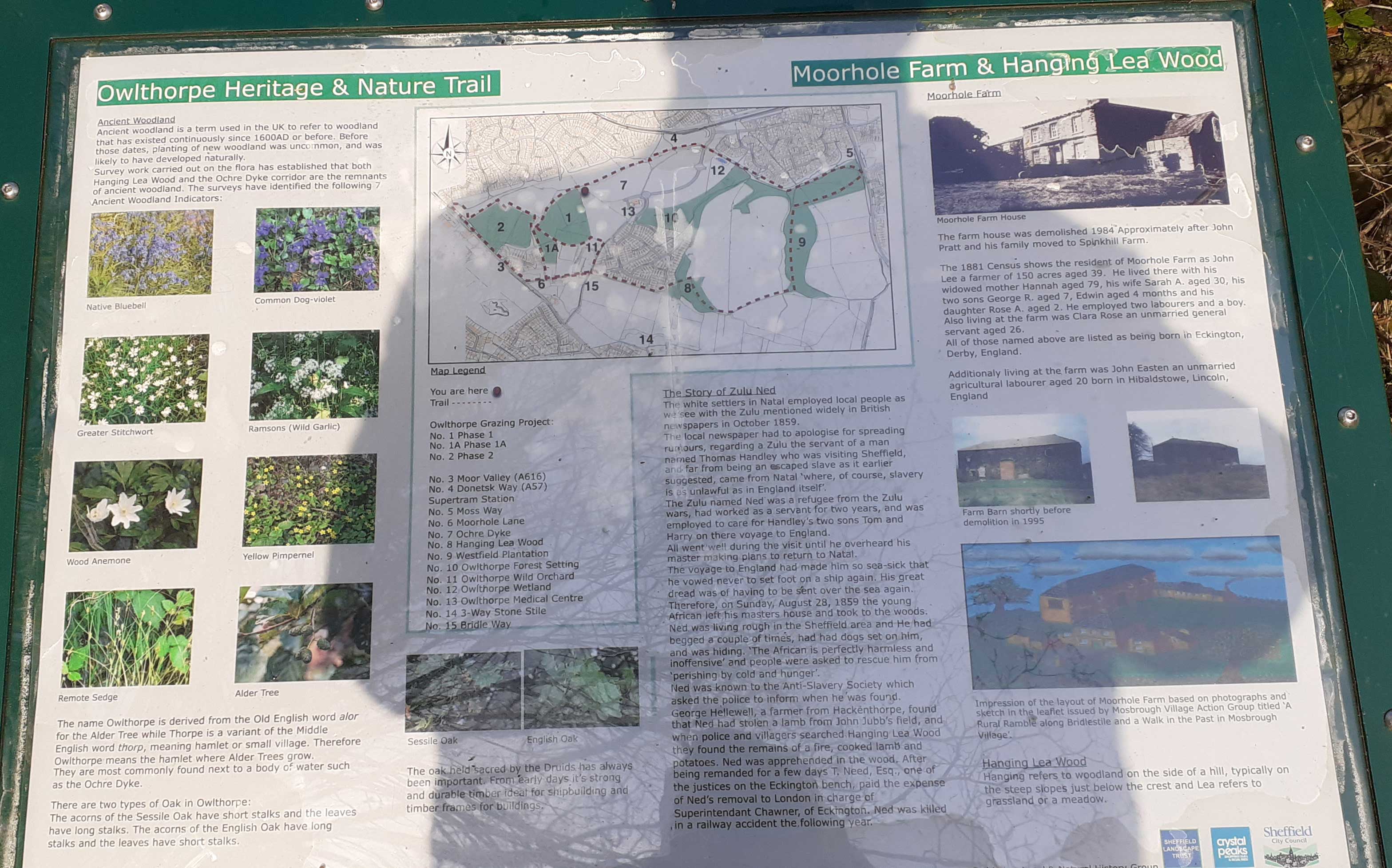
(5) Duble click on the (Notice Board) to obtain a large on-line readable version of the interpritation Board regarding Hanging Lea Wood
The name Owlthorpe is derived from the Old English word alor for the Alder Tree while Thorpe is is a varient of the Middle English word thorp, meaning hamlet or small village. Therefore Owlthorpe means the hamlet where alder trees grow. They are most commonly found next to a body of water such as the Ochre Dyke.
Approx: 412ft Above sea level
GPS Co-ordinates 53.33602,-1.378730 |
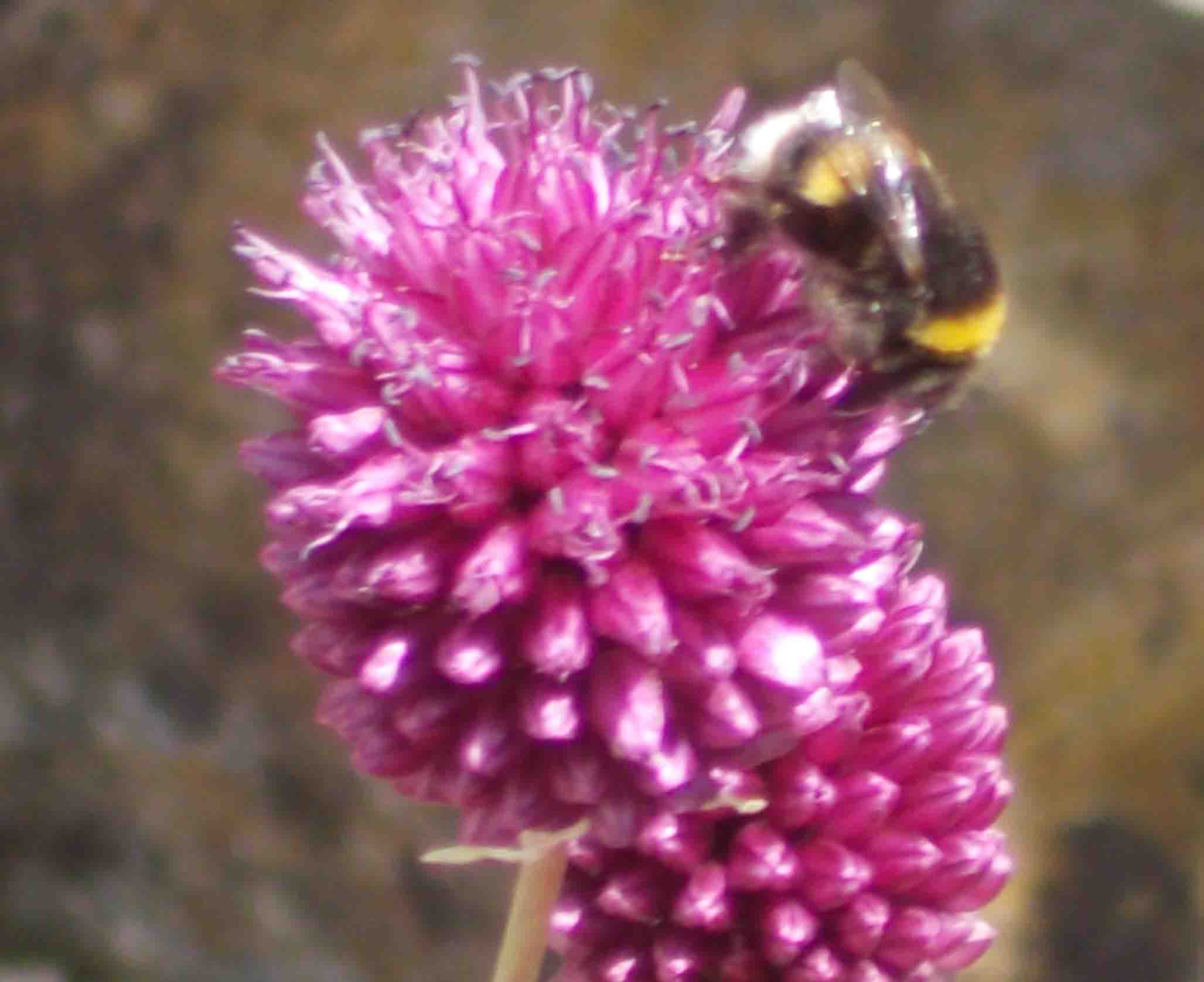
( 35) Bumblebee's
Bumblebee's have now colonised Grazing plot 2 and are nesting. Plenty of hive bees also present on this site
GPS Co-ordinates 53.33763,-1.38393 |
t
(45) Video of Nature Trail Winer
This walk is enjoyed by dog walkers and people just enjoying our oasis.
GPS Co-ordinates 53.34,-1.37515
|
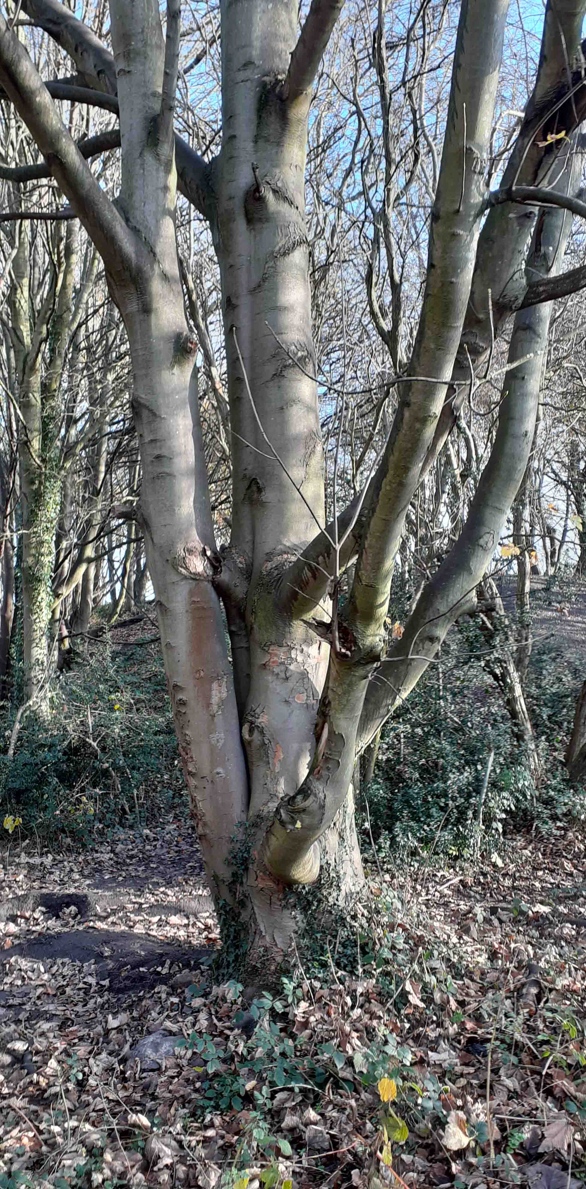
(30) Tree in Ochre Dyke Woods
This tree lives up in the area between the colvert and the caped of mine shaft. Most of the year this area is flooded.
GPS Co-ordinates 53.33898,-1.38394 |
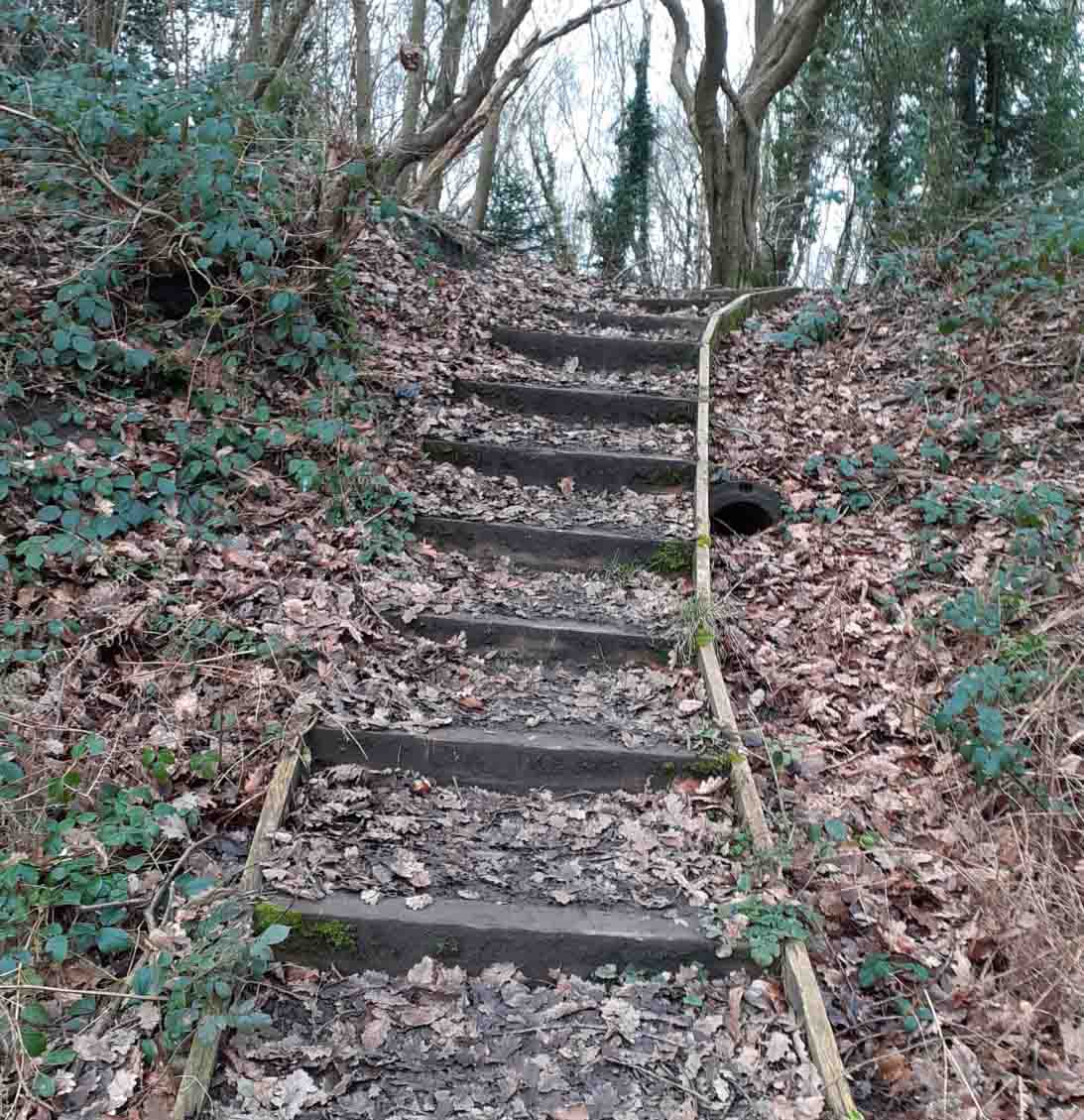
(27) The Steps Owlthorpe Nature Trail
The steps lead up to the caped of mineshaft of Moor hole Pits.
Approx.: 382ft Above sea level
GPS Co-ordinates 53.33889,-1.380750 |
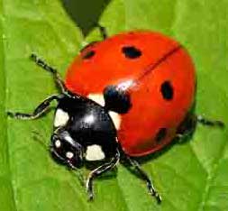
(34) Ladybirds
Huge numbers of Ladybirds basking in late March sunshine on trunks of small trees. In a survey of Phase 2 Grassland Grazing project 1139 were counted.
The assumption is that Phase 2 is an important hibernation site for Ladybirds and an important spring basking site. The requirements appear to be the presence of small trees in a warm, sunny position.
GPS Co-ordinates 53.33804,-1.38371 |
(28) Colliery Drift Capped off
The photo shows Moorhole Colliery pit head now capped off.
There was a tramway which ran under Moor Valley and down to the Colliery drift.
Approx: 382ft above sea Level
GPS Co-ordinates 53.33889,-1.380750
|
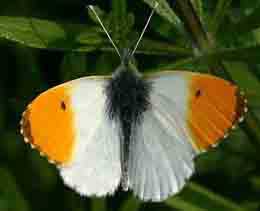
(49) Orange Tip Butterfly
Excellent numbers of Orange tip Butterflies seen in Grazing plot 2.
GPS Co-ordinates 53.33835, -1.38432 |
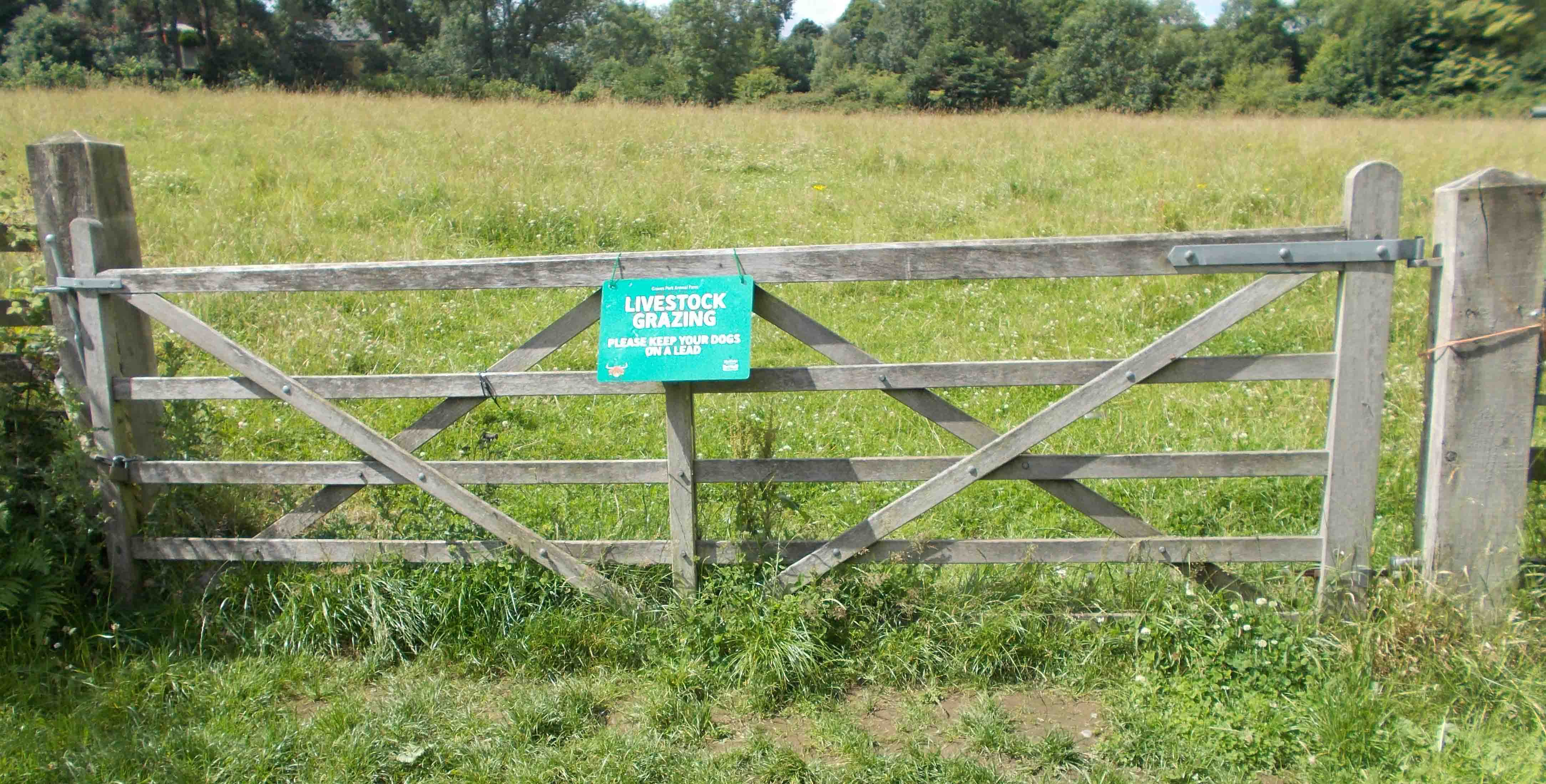
( 31) Gate to Grassland Project
https://www.ecological-owlthorpe.org/owlthorpegrassland.htm
Visitors often see animals from Graves park animal farm. As they take their vacation.
GPS Co-ordinates 53.33775,-1.38199
|
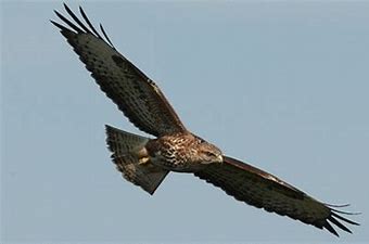
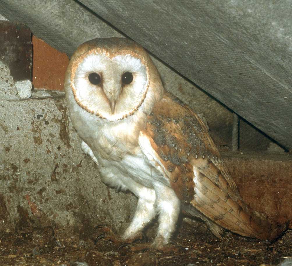
( 17) Buzzard
(18) The buzzards can be seen all over Owlthorpe. Gliding on the thermals they provide a spectacular aerial display.
|
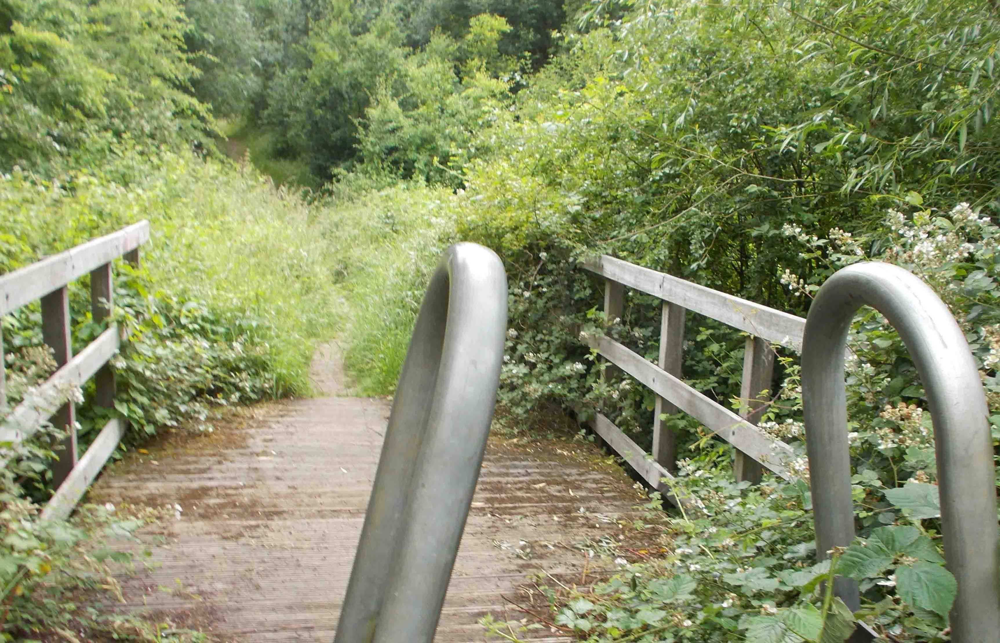
(11) Bridge Westfield Plantation
https://www.ecological-owlthorpe.org/westfieldplantation.htm
The bridge over the Ochre Dyke leads to Westfield Plantation.
Approx: 253ft Above sea level
GPS Co-ordinates 53.33975,-1.36422
|
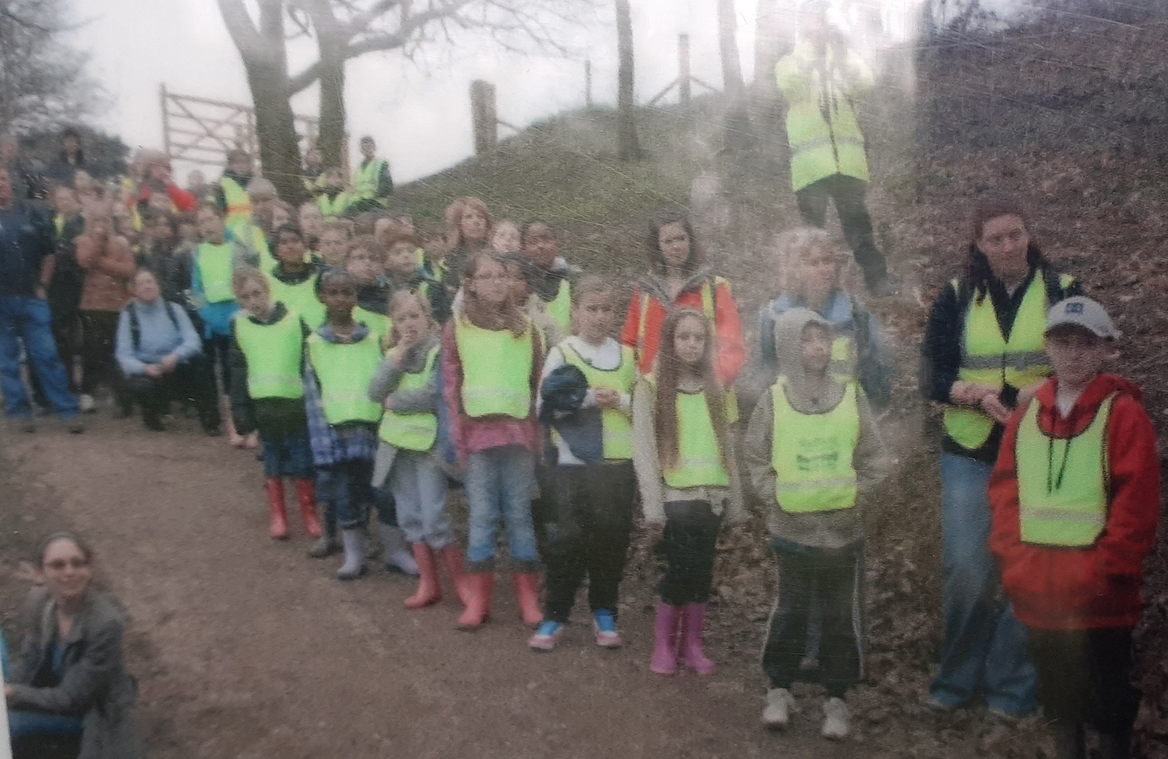
(21) Children helping on the project
A big thank you to the hundreds of Children who helped in the construction of Owlthorpe Heritage & Nature Trail.
Approx.: 300ft above sea level
GPS Co-ordinates 53.34001,-1.375
|
(9) Bridge to Owlthorpe Forest Settings
https://www.ecological-owlthorpe.org/owlthorpeforestsettings.htm
This bridge leads over the Ochre Dyke and up to the playing fields of Owlthorpe Forest Settings.
GPS Co-ordinates 53.33997,-1.370050
|
(63) Birley Moor Garden Centre
https://www.facebook.com/BirleyMoorGardenCentre/?locale=en_GB
Traditional Family run Garden Centre, stocking a wide range of goods for all your gardening needs.
|
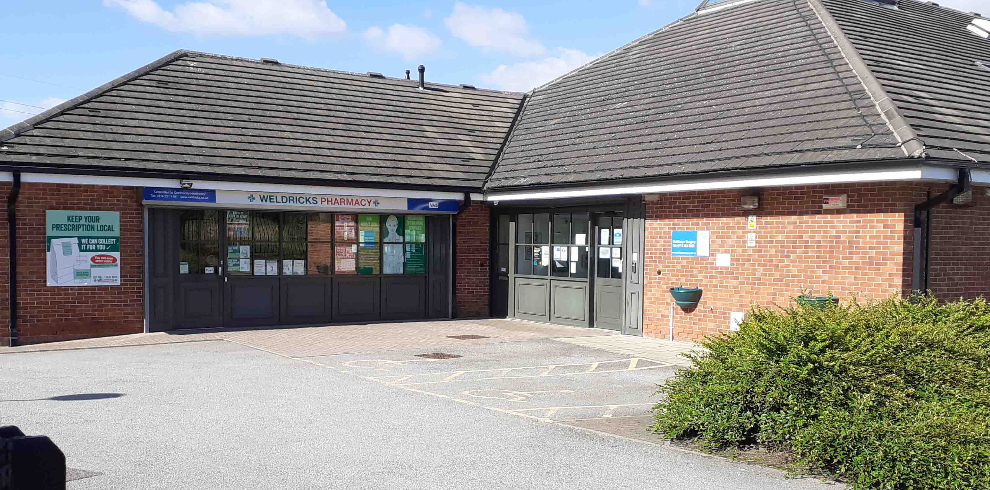
(18) Owlthorpe Surgery + Pharmacy
The surgery provides all our medical needs to keep us in good health.
Approx: 312ft Above sea level
GPS Co-ordinates 53.33840,-1.376120 |
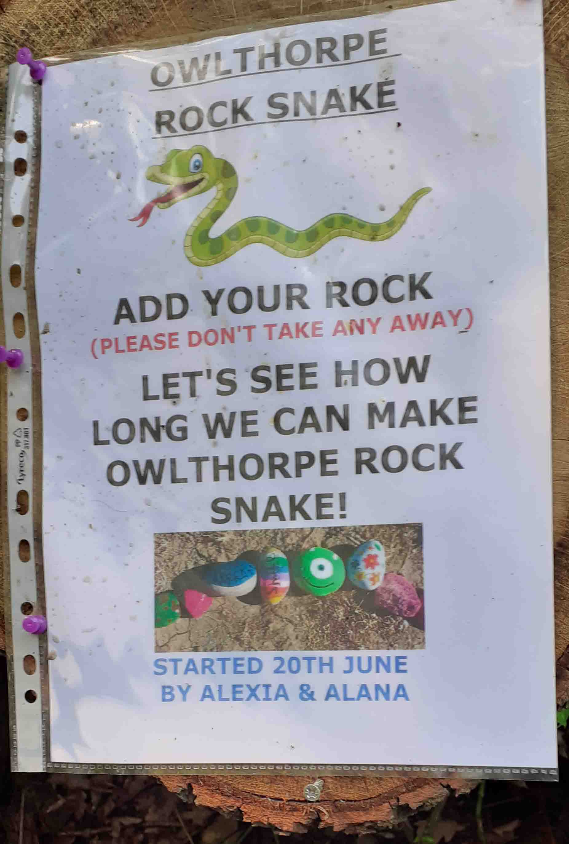
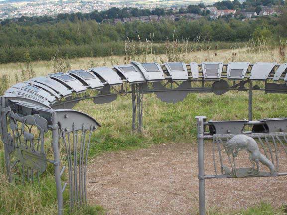
The Rock Snake has encouraged children to take their parents to contribute their own painted rocks to the snake. This is testimony to how many families with children are taking advantage of this valuable outdoor space. The NHS recommends exercise as a means of maintaining both physical and mental wellbeing. Many residents of Owlthorpe enjoy taking their children for a walk in Owlthorpe Heritage & Nature Trail. |
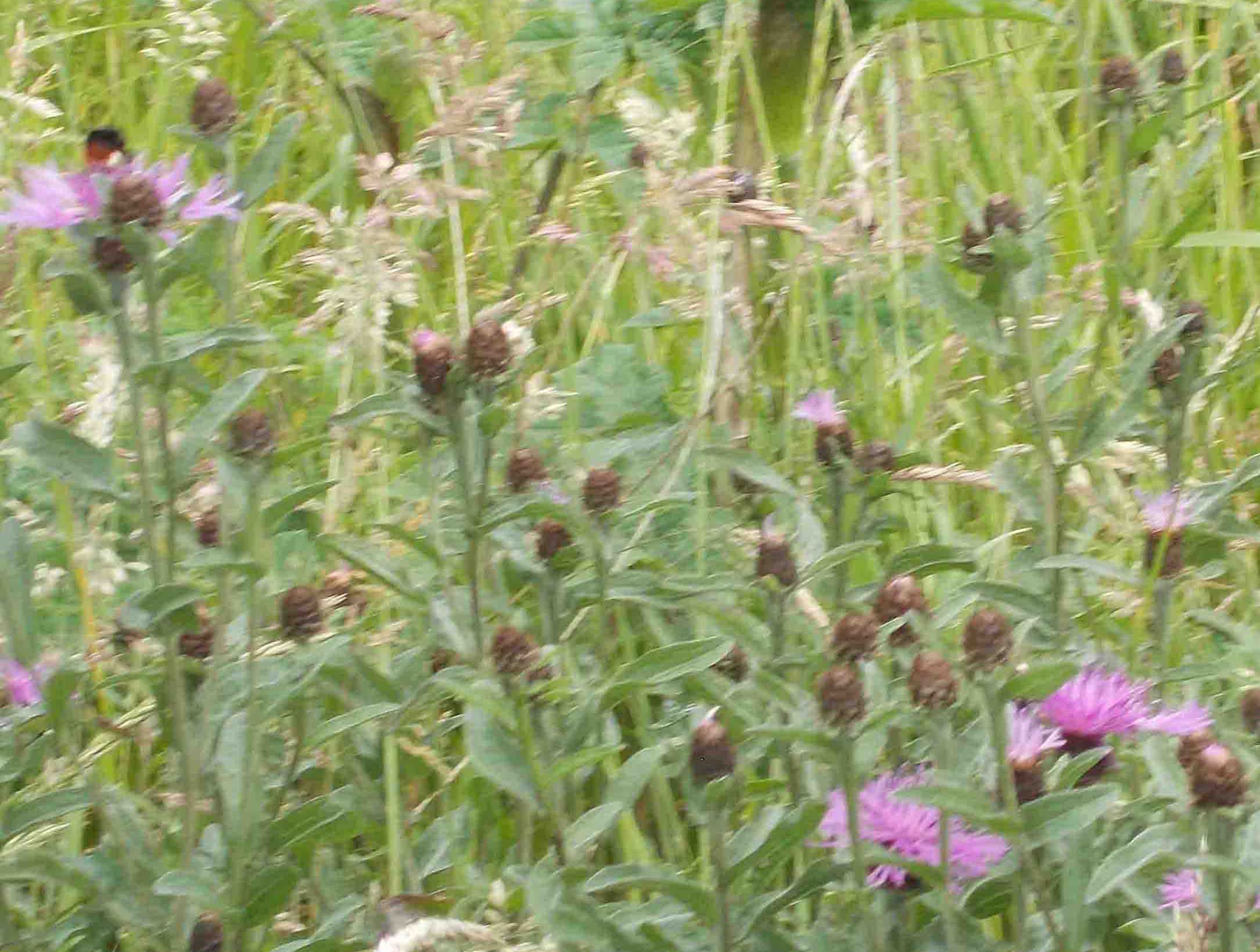
(16) Owlthorpe Fields
https://www.ecological-owlthorpe.org/owlthorpefields.htm
Can you spot the bee in this photo.
GPS Co-ordinates 53.33937,-1.37423 |
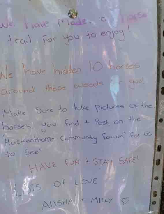
Children have organised a paper chase hiding pictures of Ponies and Horses and requested other children look for them. After finding them they were encouraged to send photos of the location of their discoveries, to Hackenthorpe Community forum.
Incidentally there is a bridle way at the bottom of Moorhole Lane which leads up to Moor Vally, although it has become somewhat overgrown. |
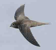
(46) Swift
The swifts are so agile as they feed on the wing swooping over the grassland and Grazing project.
GPS Co-ordinates 53.33837,-1.38302
|
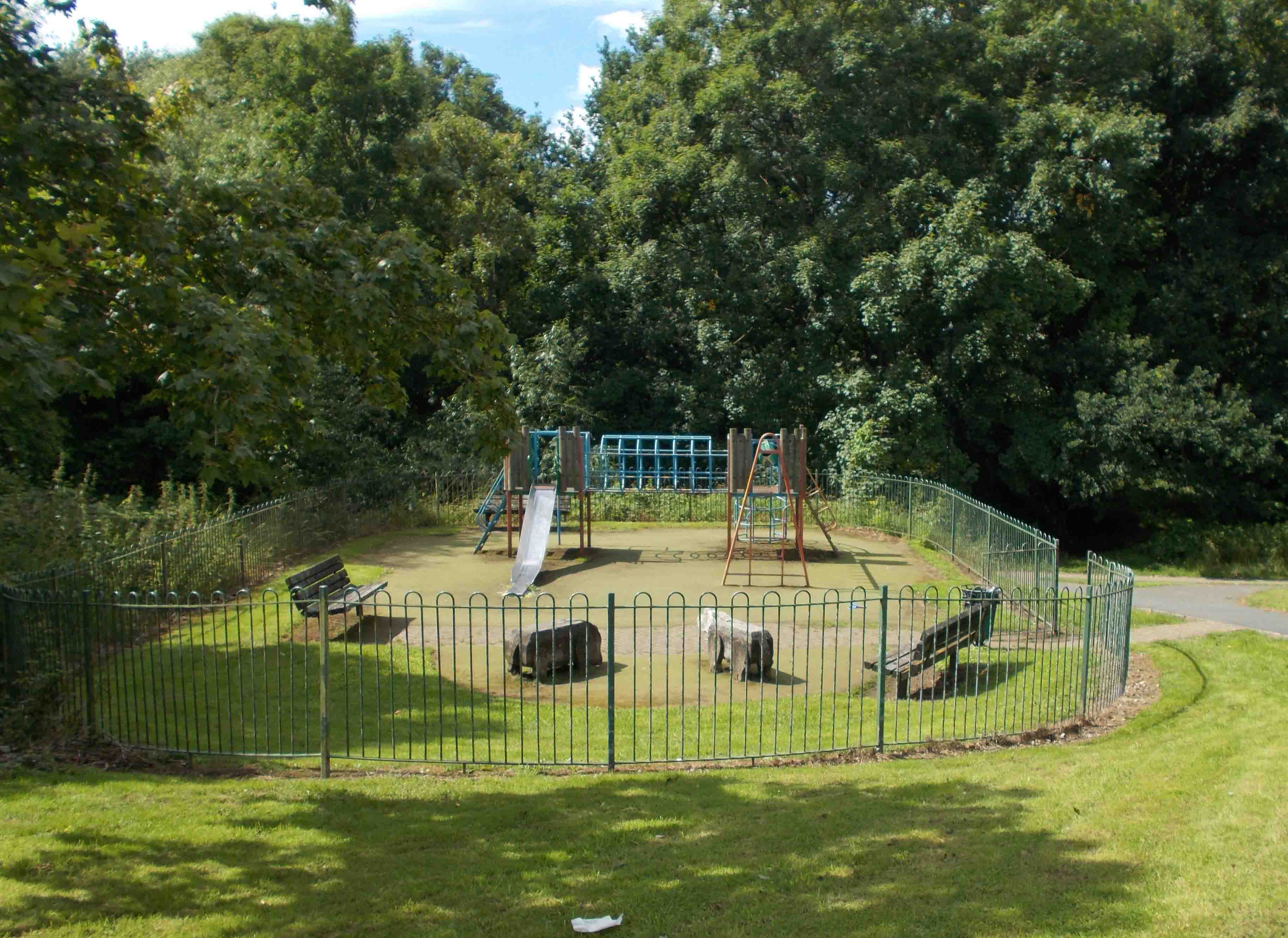
(13) Eden Thorp PlayGround
GPS Co-ordinates 53.33947,-1.36879
|
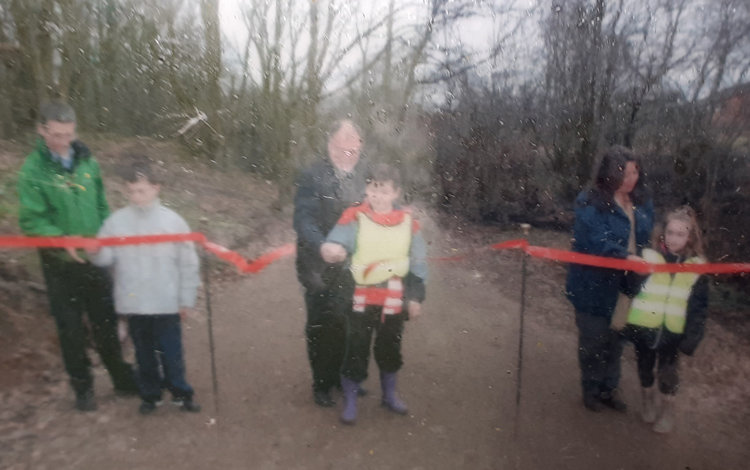
(22) Opening ceremony of Owlthorpe Heritage & Nature Trail.
The official event took place on 16th March 2012. By David Caufield Sheffield City Council Officer, Clive Bette MP for Sheffield South East and Sheffield City Councilor Helen Mirfin-Boukouris.
Approx.: 298ft above sea level
GPS Co-ordinates 53.34003,-1.37533
|
(64) Dent (Birley Wood Pits)
The workings at the colliery face were always in orange coloured "Ochre Water" due to the iron deposits in the workings, the water being continually pumped from the pit.
Approx.: 454ft above sea level
GPS Co-ordinates 53.33815,-1.38877
|
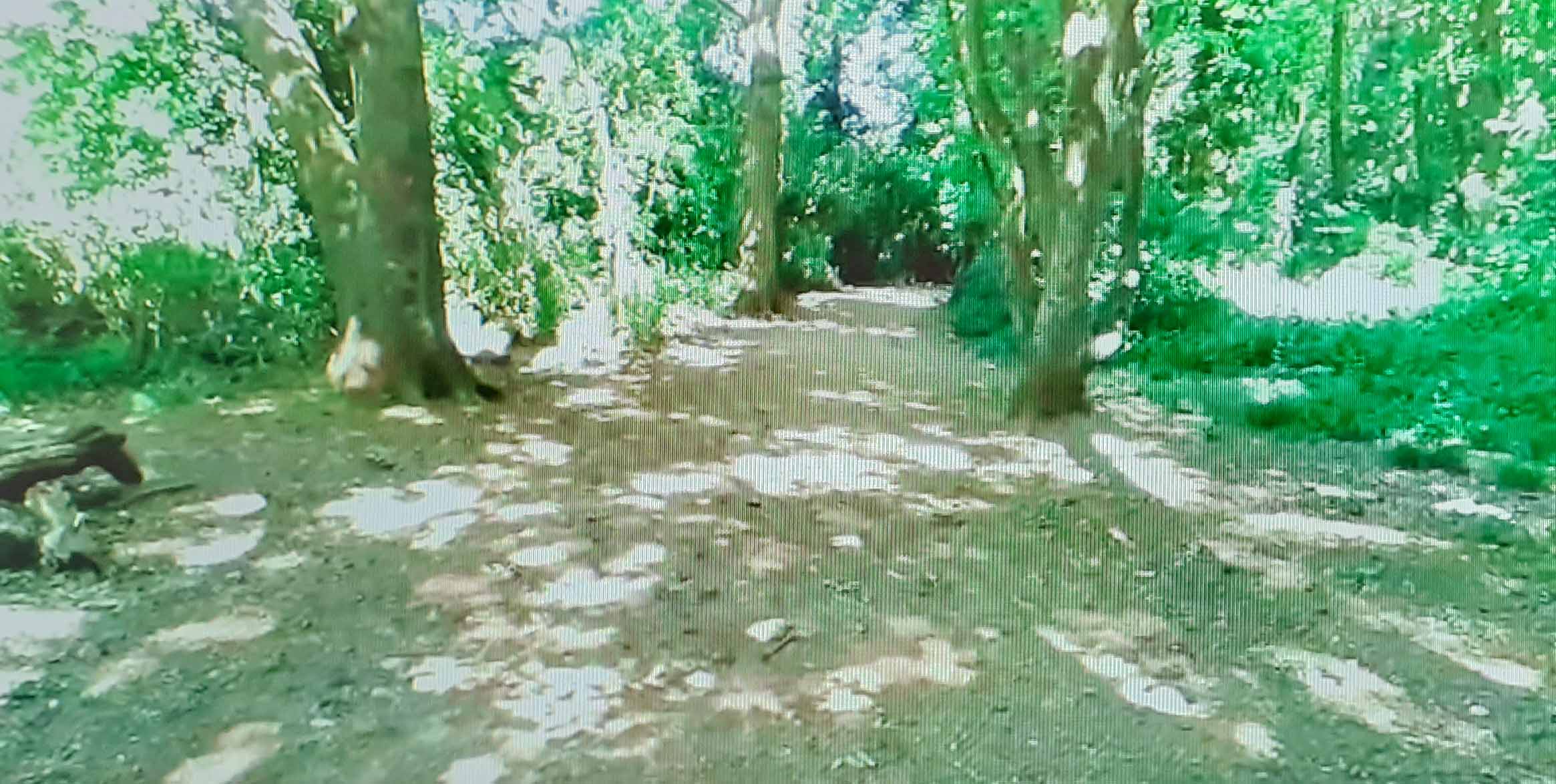
(25) Walking on Nature Trail.
We have some wonderful specimens of Trees in Owlthorpe Heritage & Nature Trail.
Approx.: 314ft above sea Level
GPS Co-ordinates 53.33967,-1.37755 |
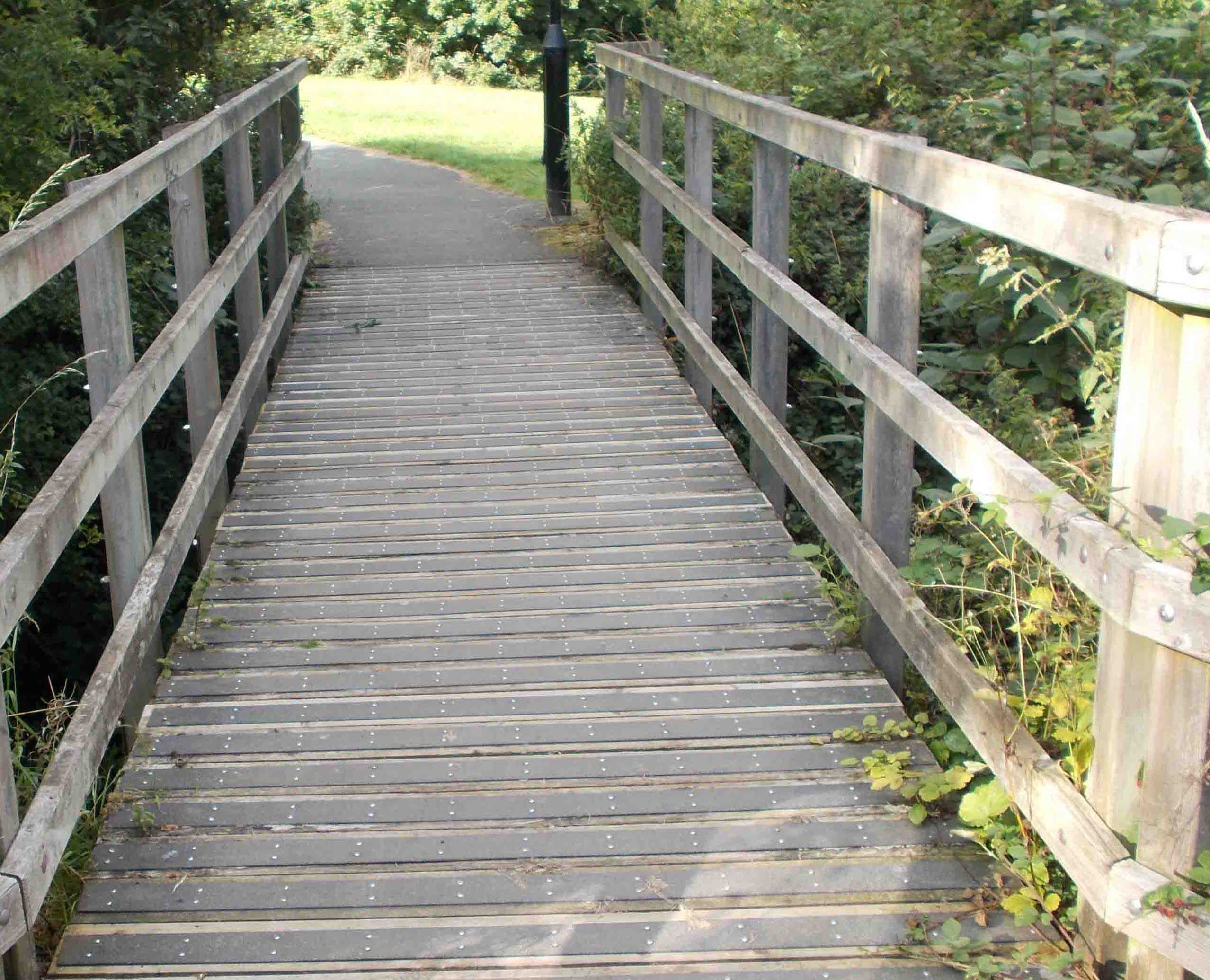
(26) Bridge Owlthorpe Nature Trail
This bridge was installed as part of the environmental project in 2012. It is used frequently.
Approx.: 326ft above sea Level
GPS Co-ordinates 53.33933,-1.379030
|
|
|
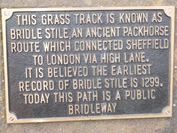
(39) Bridle Stile Mosborough
This was the M1 of the day transporting goods to and from Sheffield.
Approx:516ft above Sea Level
GPS Co-ordinates 53.328617,-1.374355
|
(40) Timeline Sculpture Mosborough
Well worth a visit the notice boards show the direction and distance to many cityies around the world.
GPS Co-ordinates 53.32775,-1.37361 |
|
(45) Video of Water Rretension
This video shows the amount of water stored in Owlthorpe stopping Downstream flooding.
GPS Co-ordinates 53.33828,-1.3775 |
.jpg)
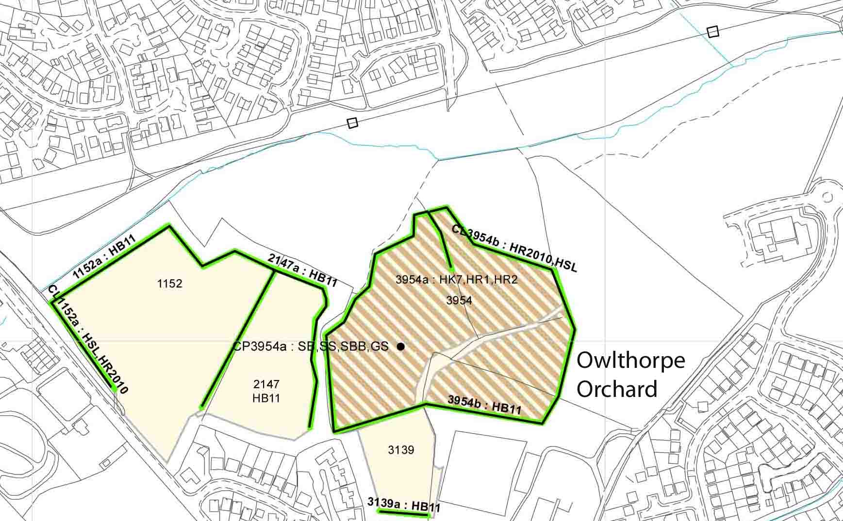
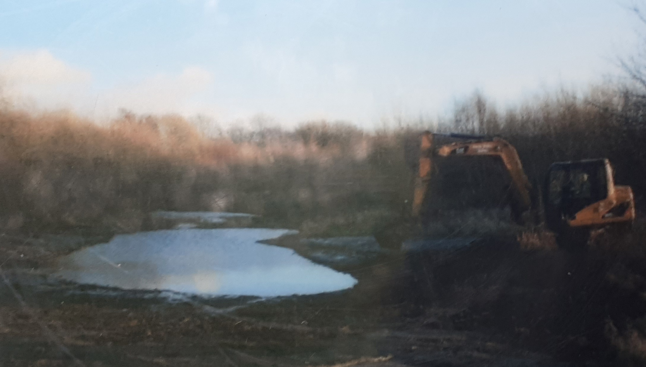
(20) The destruction of Plot E.
To see evidence, we supplied to the Planning Inspector click here
https://www.ecological-owlthorpe.org/publicinquiry.htm
We are not happy with the decision made by Inspector O S Woodwards. Formal complaint has been made to the Parliamentary Ombudsman.
GPS Coordinates 53.33921,-1.37542 |
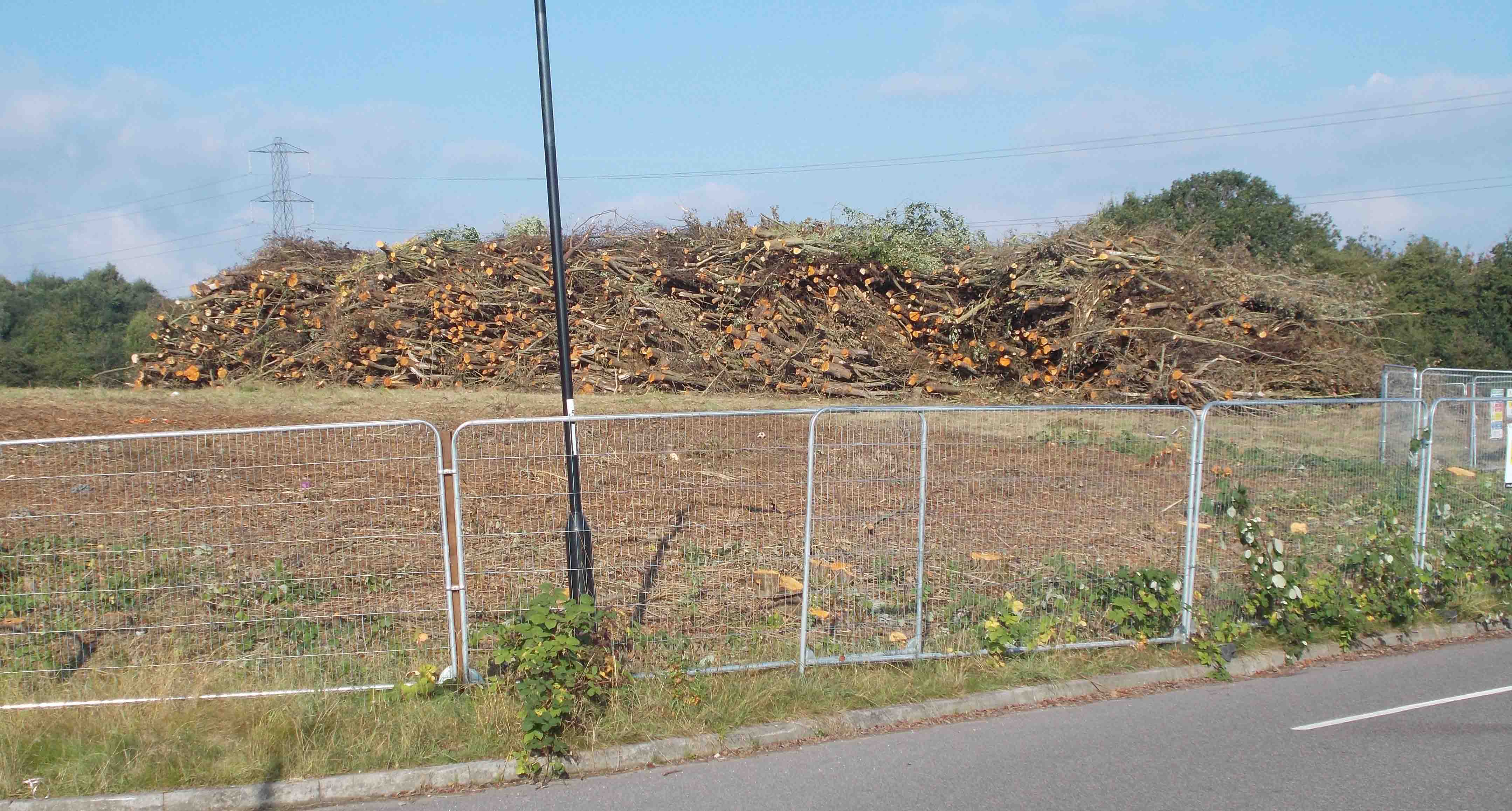
(19) Deforestation on Site E
Destroying trees on site E to make way for new housing estates will incise the flow of runoff waters. This has the Potential of making downstream flooding more devastating than it already is.
Approx: 315ft Above sea level
GPS Co-ordinates 53.33886,-1.37729 |
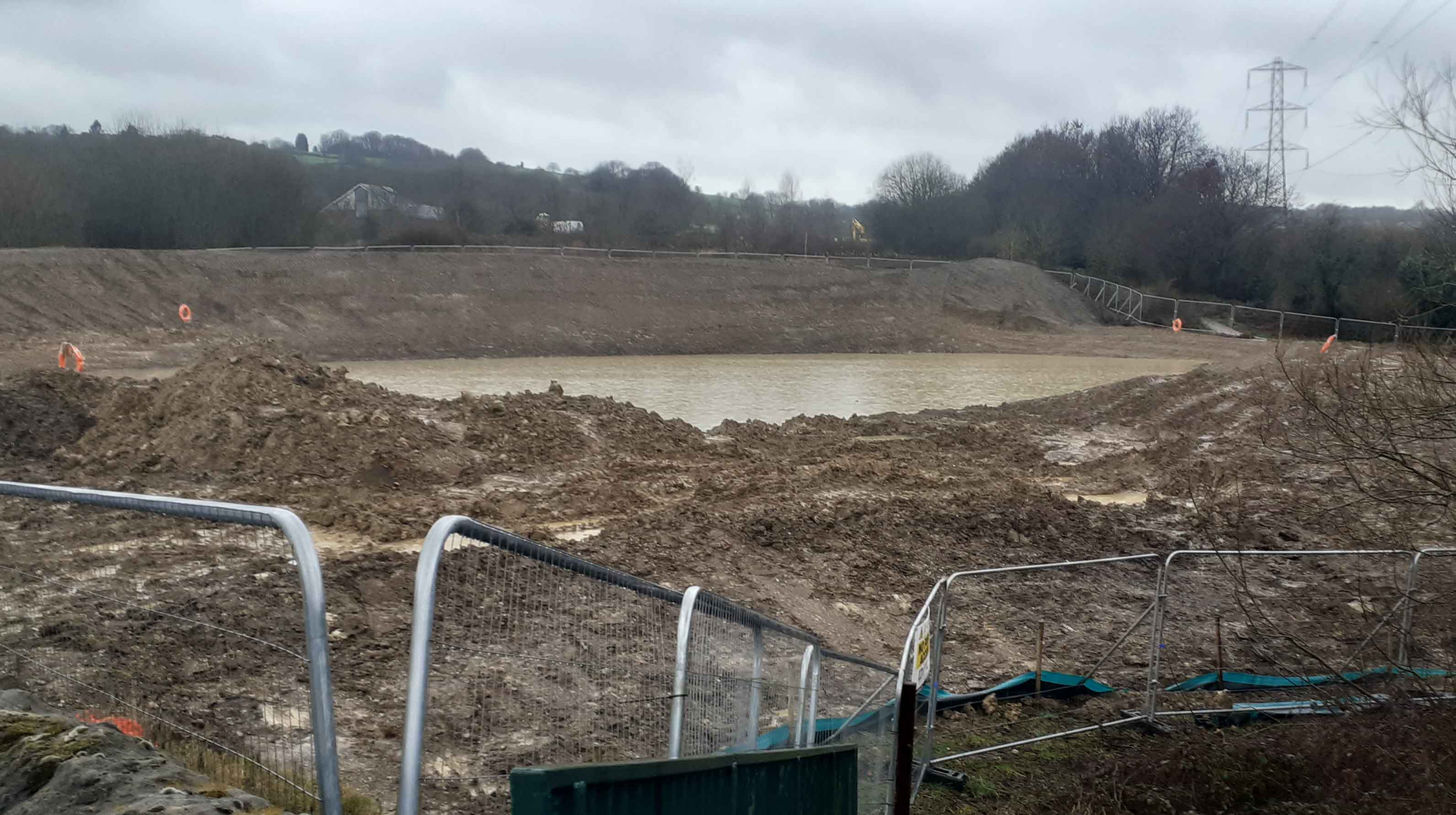
(15) S. U. D. S.
Many residents of Owlthorpe have been concerned about the SUDS system on site D. In October 2023 the volume of water from the overflow caused the Ochre Dyke to flood Moorthorpe Gate Pedestrian Underpass making it unusable.
GPS Co-ordinates 53.34077,-1.3728 |
|
|
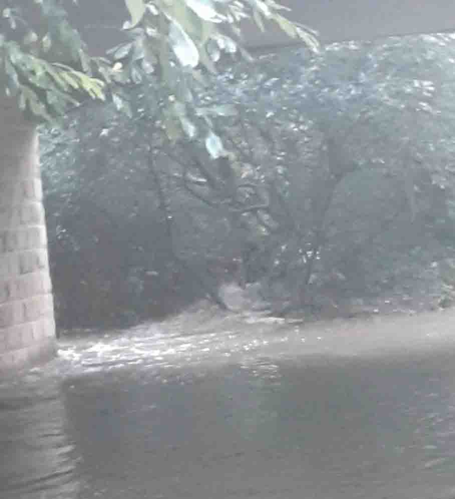
(54) Pedestrian Underpass Flooding
https://www.ecological-owlthorpe.org/MoothorpeGatepedestrianunderpassFlooding.mp4
October 2023 Sheffield Flooding again.
Standing 650ft above sea level, water from the Golf Course at Birley cascaded across Moor Valley and onto plot F. This grassland grazing project acts as a flood plain and absorbs much of the water, releasing it gently into the Ochre Dyke which helps prevent downstream flooding.
Just after the point on the Ochre Dyke where the drainage for the new SUDS system is situated the Ochre Dyke flooded making the Moothorpe Gate pedestrian underpass unusable. |
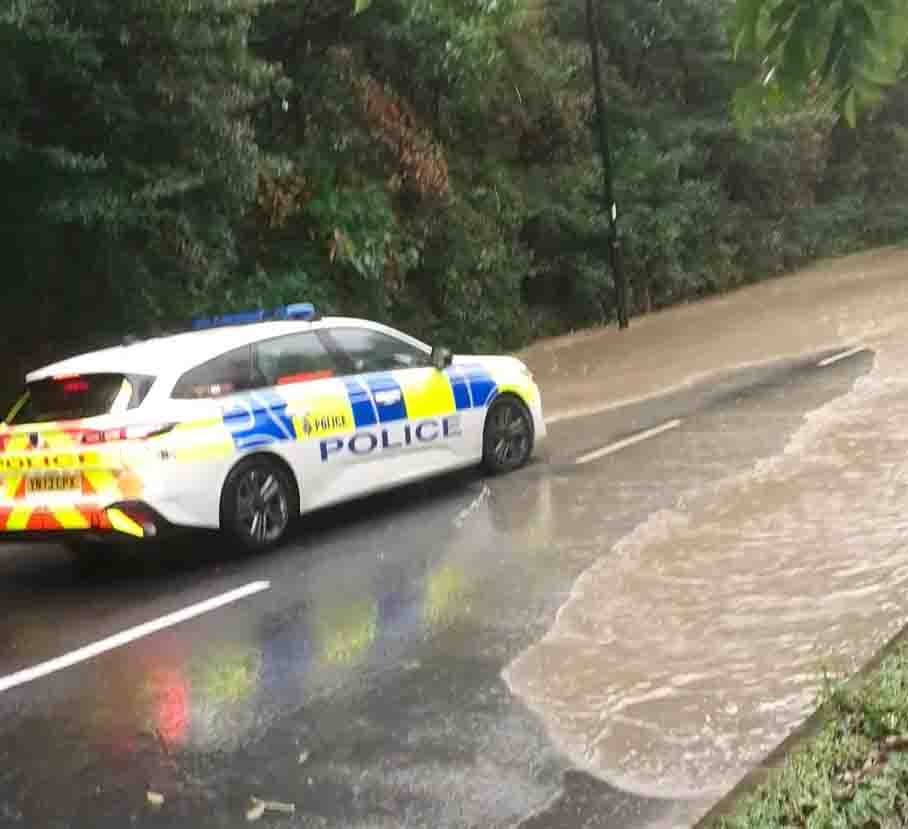
(55) Moss way Flooding
https://www.ecological-owlthorpe.org/MossWayFlooding.mp4
Water poured off Owlthorpe Fields and on to Moss way making it difficult for traffic to pass. The water then flowed into the Ochre Dyke swelling it further.
The grasslands, hedgerows, and trees of Owlthorpe hold millions of gallons of water helping to prevent downstream flooding. We need to discourage Sheffield (LPA) from building more properties in Owlthorpe. We do not want to increase the flood risk downstream in Waterthorpe, Beighton and beyond |
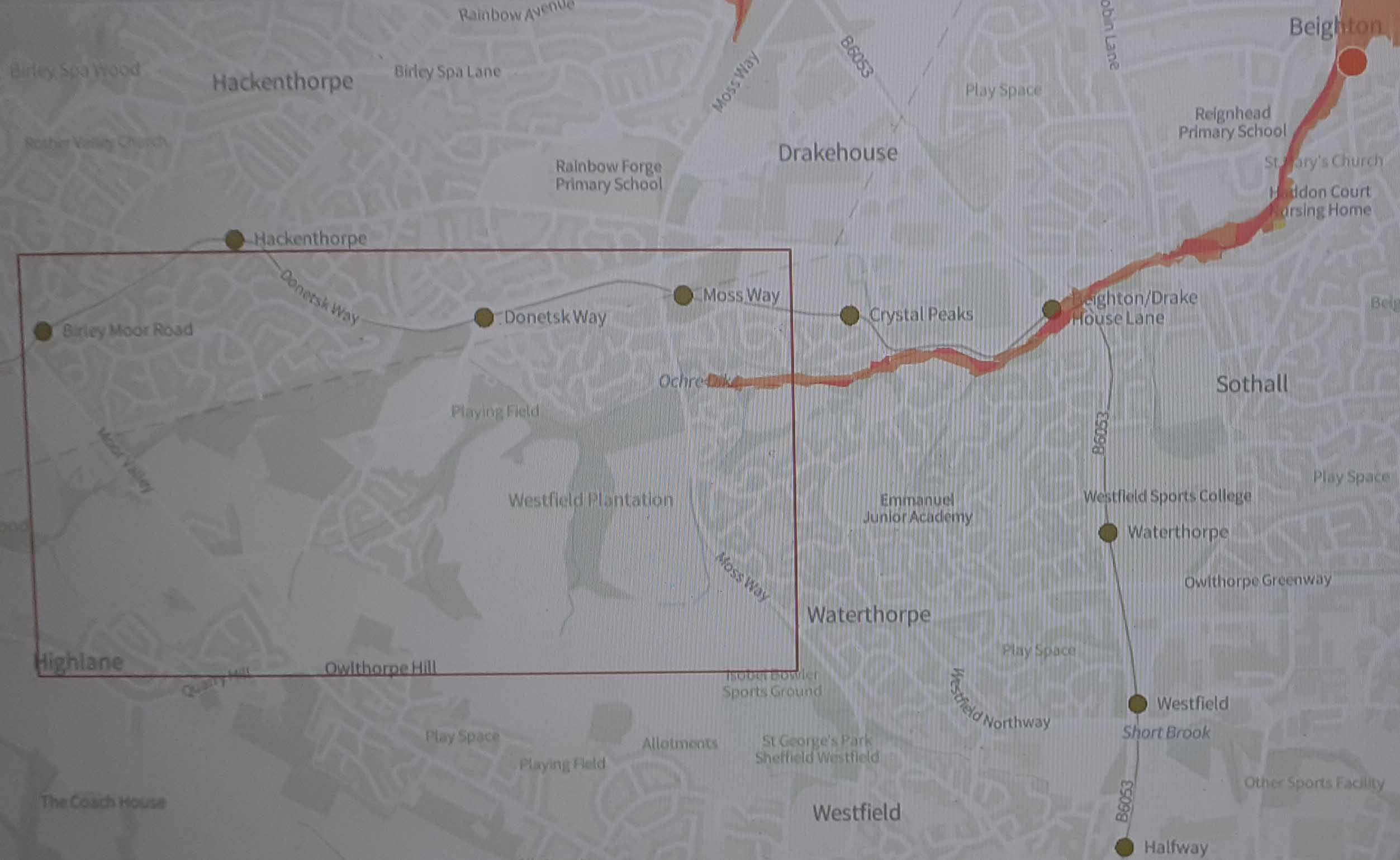
(12) Moss Way flood Map
The flood map shows the flooding caused by water flooding out of the mines that run under Owlthorpe.
Approx.: 212ft
GPS Co-ordinates 53.340038,-1.362883
|
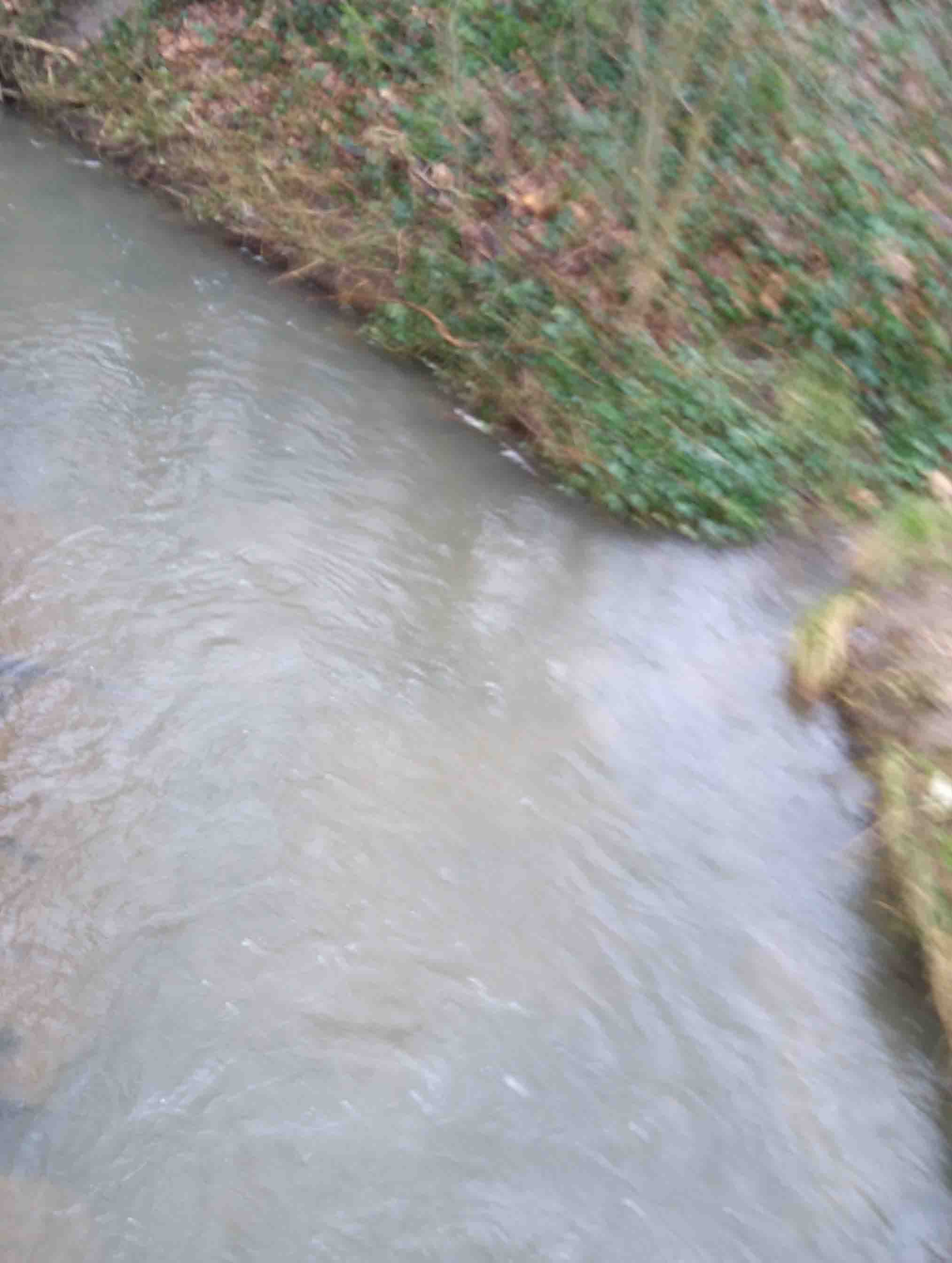
(41) Ochre Dyke behind Crystal Peaks
https://www.ecological-owlthorpe.org/Ochredyke2.mp4
The collaring of the water is ochre that has been washed out of the old mineworking's that run under Owlthorpe the Ochre Dyke then passes behind Crystal Peaks
Approx.: 178ft Above sea level
GPS Co-ordinates 53.340838,-1.352346 |
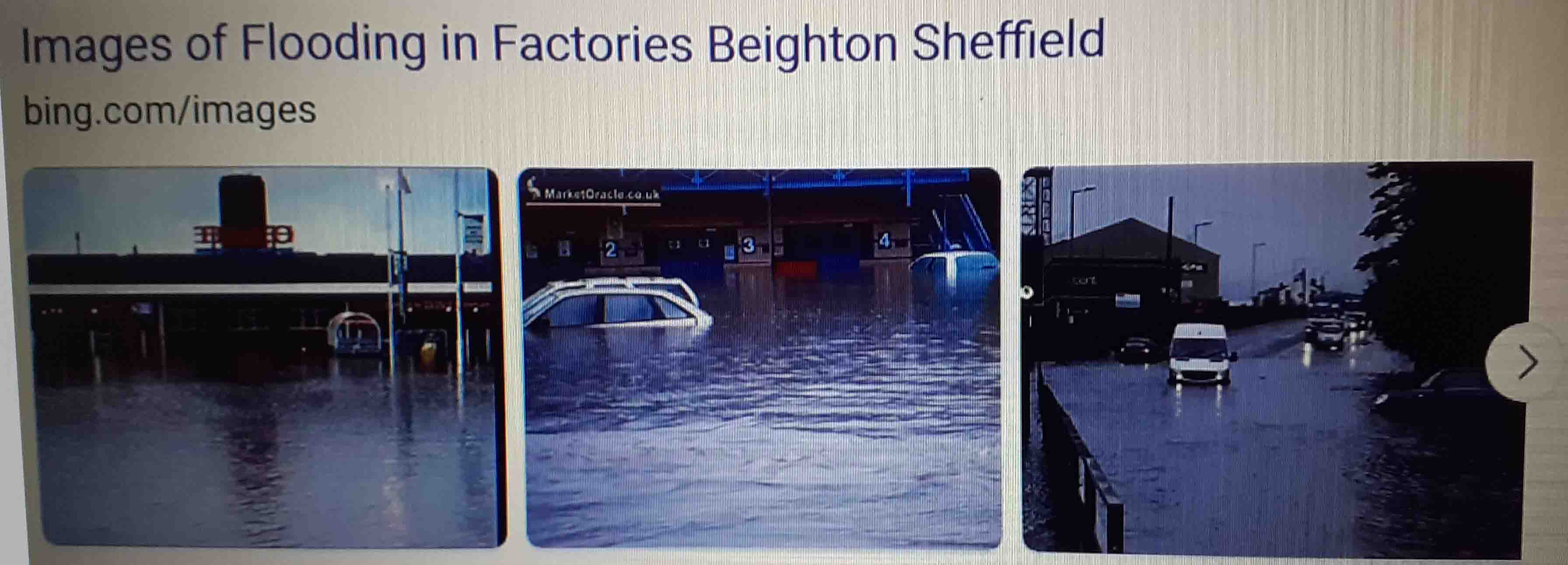
(42) Beighton Flooding
After the flood waters receded it was not only the damage to property but also, Ochre deposits, that had been washed out of the old mineworking's that run under Owlthorpe, were found on farmland. Ochre can affect the food chain.
GPS Co-ordinates 53.34726,-1.33538
|
(56) Catcliffe Flooding
October 2023 Storm Babet caused flooding in Catcliffe.
Some of the Runoff water in the upstream Ochre Dyke which was swollen by deforestation due to building of new housing in Owlthorpe did contribute to an increase in the flow of flood water into the river Rother which engulfed Catcliffe.
|
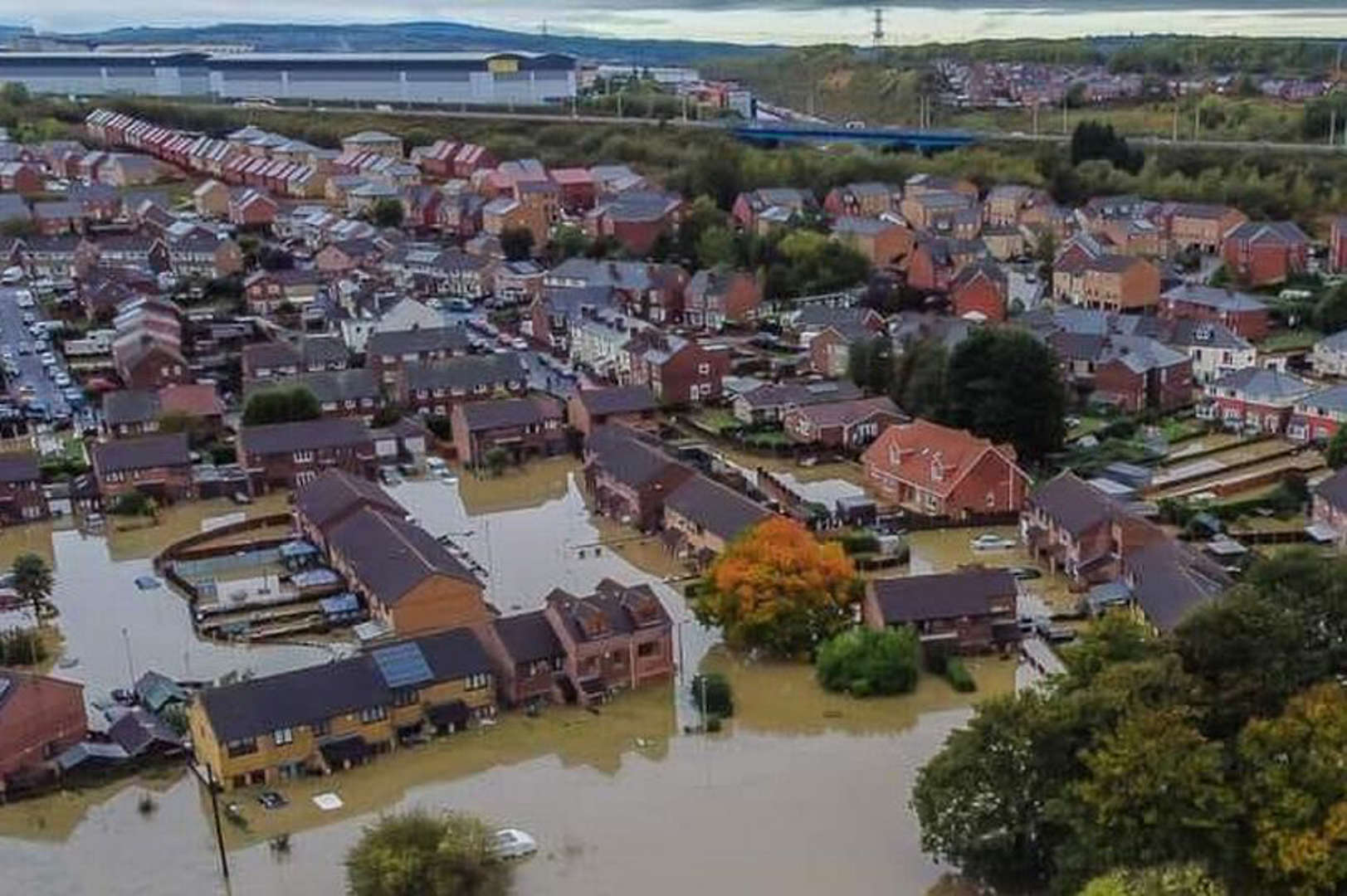
(43) History of Downstream Flooding (Fishlake)
https://www.ecological-owlthorpe.org/DownstreamFlooding.html
The flooding in Fishlake was caused by vast quantities of water cascading downstream from the rivers of Sheffield and the confluence with other rivers in the Don Valley catchment area.Tthe Ochre Dyke did contribute to the flooding of Fishlake, some 31 miles downstream from Owlthorpe.
Approx: 18ft Above sea level
GPS Co-ordinates 53.610770,-1.012479 |
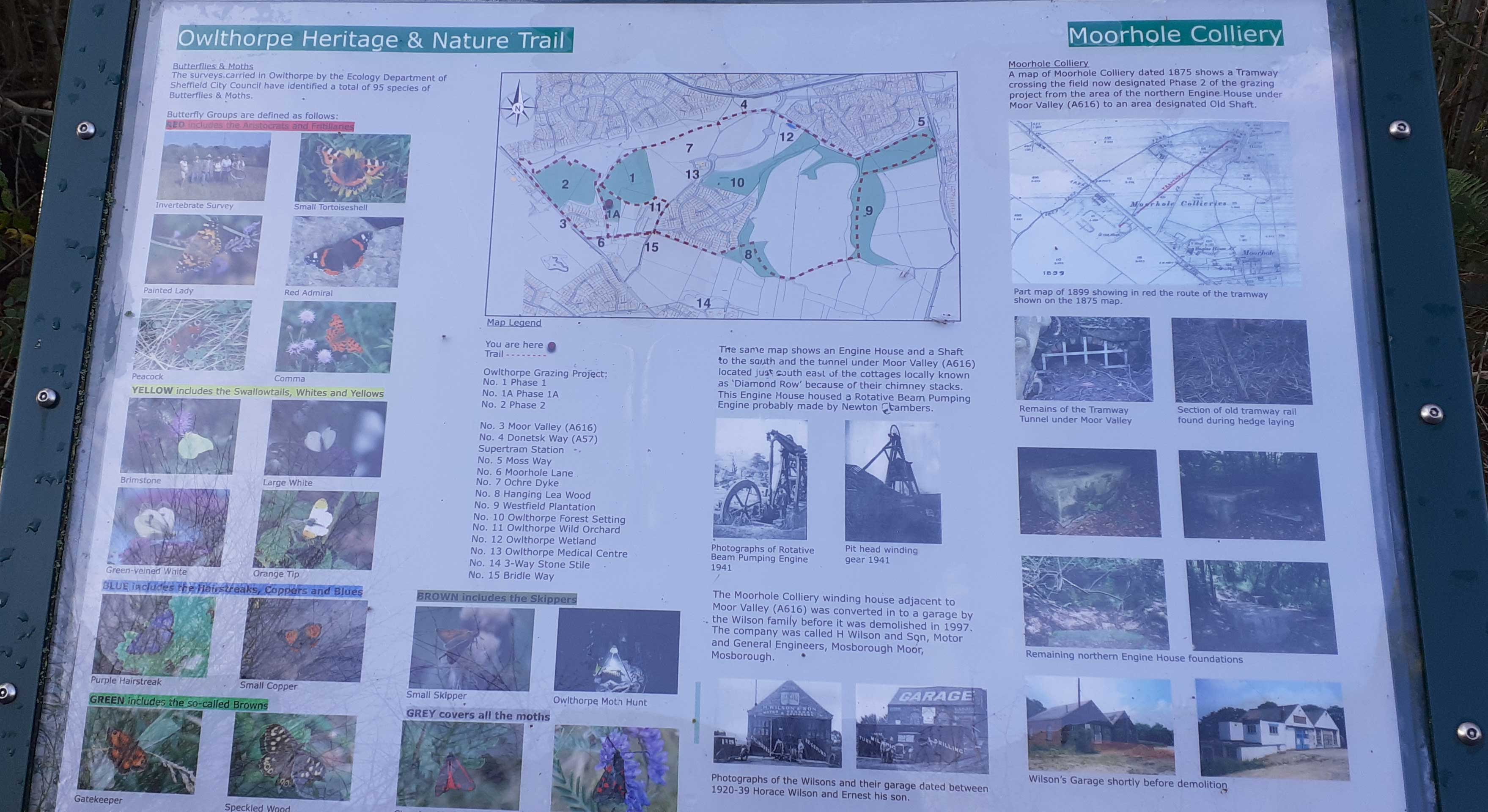
Interpritation Boards
I would like to thank the 795 local school Children who in 2012 helped to create our ecological Oasis. The project has proven both educational and environmentally friendly to all who visit.
Also I thank Crystal Peaks Shopping Mall and retail Park for part funding the Interpretation Boards situated in many locations around Ecological Owlthorpe. |
Map boundary as set under the guidance of Natural England 2012
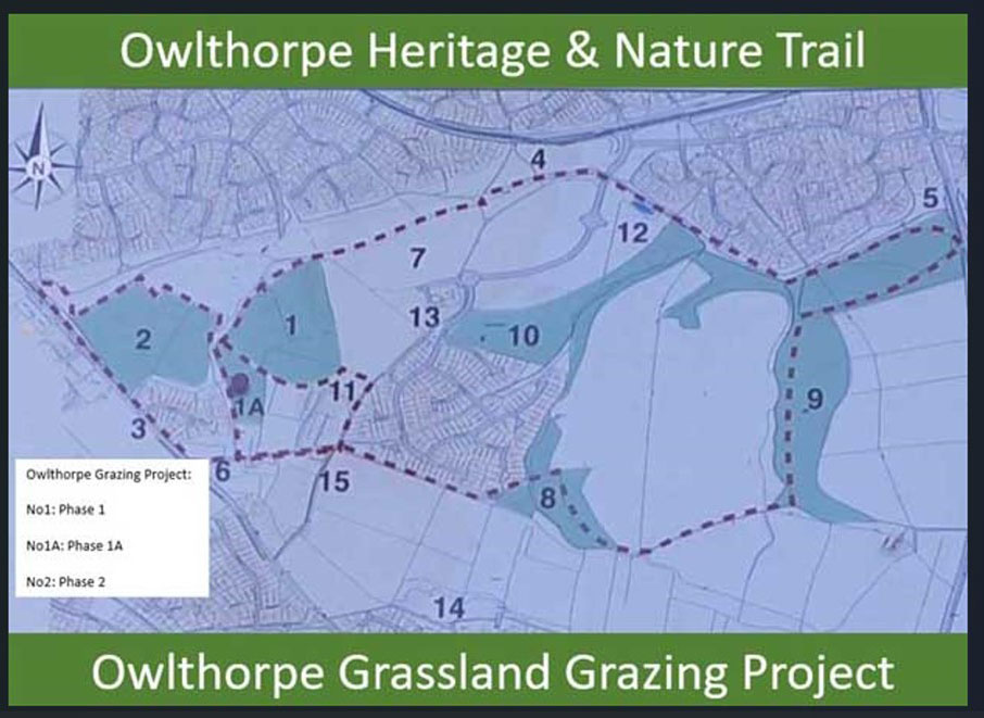
Interpretation Board
Showing the extent of conservation work carried out.
Owlthorpe Grazing Project:( No. 1 Phase 1), (No. 1A Phase 1A), (No 2 Phase 2)
(No 3 Moor Valley A616)----(No 4 Donetsk Way A57)
(Supertram Station)----(No 5 Moss Way)
(No 6 Moorhole Lane)----(No 7 Ochre Dyke)
(No 8 Hanging Lee Wood)----(No 9 Westfield Plantation)
(No 10 Owlthorpe Forest Setting)----(No 11 Owlthorpe Wild Orchard)
(No 12 Owlthorpe Wetland)----(No 13 Owlthorpe Medical Centre)
(No 14 3-Way Stone Stile)----(No 15 Bridle Way)
To find location copy GPS Co-ordinates into Google Map |
Approx height above sea Level |
GPS Co-ordinates |
Birley Moor Golf CourseApprox: 650ft |
53.33975,-1.402474 |
3 Way Stile Approx: 502ft |
53.33297,-1.375590 |
Hanging Lea Wood Approx: 475Ft |
53.33437,-1.376210 |
|
53.33581,-1.381140 |
Birley Moor Garden Centre Approx: 438ft
Post Code:S20 5BB
|
|
Diamond Cottages Approx: 423ft |
53.33765,-1.385460 |
Culvert opposite Garden Centre Approx: 420ft |
53.33822,-1.385700 |
|
53.33602,-1.378730 |
|
53.33712,-1.381610 |
|
53.33765,-1.381870 |
Colliery Drift Capped off Approx: 382ft |
53.33889,-1.380750 |
Top of Steps Owlthorpe Nature Trail Approx: 382ft |
53.33889,-1.380750 |
|
53.33896,-1.380570 |
Bridge Owlthorpe Nature Trail Approx: 326ft |
53.33933,-1.379030 |
Owlthorpe Surgery Approx: 312ft
Post Code: S20 6PD
|
53.33840,-1.376120 |
Looking across Owlthorpe Fields Approx: 307ft |
53.33922,-1.375370 |
Owlthorpe Wetlands Approx: 260ft |
53.33997,-1.370050 |
Westfield Plantation (Gate) Approx: 260ft |
53.33826,-1.366950 |
Bridge over Ochre Dyke leading on to Owlthorpe Forest Settings Approx: 253ft |
53.33943,-1.369080 |
The Ochre Dyke passes under Moss Way at the east end of Ecological Owlthorpe Approx: 212ft |
53.340038,-1.362883 |
Ochre Dyke behind Crystal Peaks Approx: 178ft |
53.340838,-1.352346 |
Down Stream Flooding |
Beighton |
53.350554,-1.334622 |
Fishlake Approx: 23ft |
53.610770,-1.012479 |
The grasslands of Owlthorpe are very steep and hold back millions of gallons of water stopping downstream flooding. If they are destroyed to build New Housing, flooding downstream will increase.
Please read our editorial in the Yorkshire Bylines. The hyper-links provide backup evidence, supporting Sheffield campaign calling for protection of upstream environments to stop downstream flooding.
Please help save Owlthorpe Heritage & Nature Trail
By signing our petition to Sheffield City Council: https://chng.it/6vXHqcGG4S
Click here to see a map showing what is at stake:
Public Inquiry Information supporting Ecological Owlthorpe as an upstream nature based solution protecting the environment from downstream flooding. |